

Select Format
Select Condition 
Book Overview
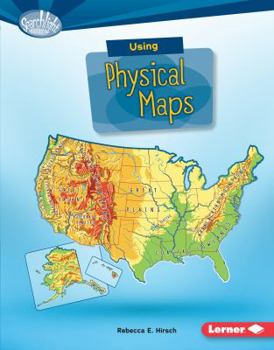
Have you ever wondered which countries have the most lakes? Or where the highest point in your state is? Physical maps show landscape features. They also often show land elevation, or how high the land is above sea level. But how do you use physical maps? And what do the different colors and symbols on these maps mean? Read on to learn all about physical maps
Format:Library Binding
Language:English
ISBN:1512409499
ISBN13:9781512409499
Release Date:August 2016
Publisher:Lerner Publications (Tm)
Length:40 Pages
Weight:0.60 lbs.
Dimensions:0.3" x 7.1" x 9.1"
Age Range:8 to 11 years
Grade Range:Grades 3 to 6
Customer Reviews
0 rating
Copyright © 2026 Thriftbooks.com
Terms of Use | Privacy Policy | Do Not Sell/Share My Personal Information | Cookie Policy | Cookie Preferences | Accessibility Statement
ThriftBooks ® and the ThriftBooks ® logo are registered trademarks of Thrift Books Global, LLC
ThriftBooks ® and the ThriftBooks ® logo are registered trademarks of Thrift Books Global, LLC
