


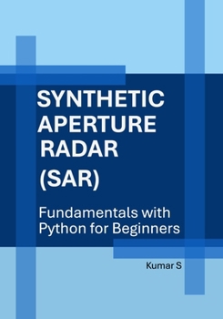
Synthetic Aperture Radar (SAR): Fundamentals with Python for Beginners
No Customer Reviews

Synthetic Aperture Radar (SAR) represents a sophisticated evolution in remote sensing technology, rooted in the principles of radar physics. At its core, radar systems utilize electromagnetic waves to detect objects and gather information about their distance, speed, and characteristics. The foundational concepts of radar, including wave propagation, reflection, and Doppler effect, are essential for understanding how SAR operates. By employing a moving platform, such as an aircraft or satellite, SAR systems can synthesize a larger aperture than physically possible, enhancing resolution and enabling detailed imaging of the Earth's surface. The image formation process in SAR is a complex interplay of signal processing techniques and geometric considerations. As the radar system transmits pulses and receives echoes from the target scene, the data collected is processed to construct high-resolution images. This involves the application of algorithms that account for the motion of the platform, the geometry of the scene, and the characteristics of the radar signal. The result is a two-dimensional image that captures the reflected energy, revealing intricate details of the terrain and objects present. Interpreting SAR data requires an understanding of backscatter mechanisms, which describe how different surfaces reflect radar signals. Various factors, such as surface roughness, moisture content, and vegetation density, influence backscatter coefficients. Analysts must also consider speckle statistics, which arise from the coherent nature of radar signals and can obscure fine details in the imagery. By employing techniques such as filtering and multi-temporal analysis, users can enhance the interpretability of SAR images, leading to valuable insights in fields such as agriculture, forestry, and urban planning. Practical projects utilizing SAR technology demonstrate its versatility and applicability across diverse domains. For instance, monitoring land subsidence, mapping flood extents, and assessing deforestation are just a few examples where SAR data has proven invaluable. These projects often integrate SAR with other remote sensing modalities, creating a comprehensive view of environmental changes. The ability to capture data under various weather conditions and times of day further emphasizes SAR's role as a powerful tool for real-time monitoring. Advanced SAR techniques such as Interferometric SAR (InSAR) and Polarimetric SAR (PolSAR) expand the capabilities of traditional imaging. InSAR exploits the phase information of radar signals to measure ground displacement with millimeter precision, providing critical data for geophysical studies and disaster response. PolSAR enhances the understanding of surface characteristics by analyzing the polarization of the radar waves, allowing for the differentiation of materials and structures based on their electromagnetic signatures. These techniques unlock new dimensions of analysis and interpretation, broadening the scope of SAR applications. The integration of machine learning into SAR analysis represents a frontier in remote sensing research. By harnessing vast datasets and sophisticated algorithms, machine learning can automate the classification of land cover types, detect changes over time, and improve image quality. This synergy between SAR technology and machine learning not only enhances the efficiency of data processing but also opens avenues for innovative applications in environmental monitoring, urban development, and disaster management. As the field continues to evolve, the interplay between traditional radar principles and cutting-edge computational techniques will undoubtedly shape the future of Synthetic Aperture Radar.
Format:Paperback
Language:English
ISBN:B0H9R71SH5
ISBN13:9798188288662
Release Date:July 2026
Publisher:Independently Published
Length:500 Pages
Weight:1.89 lbs.
Dimensions:1.0" x 7.0" x 10.0"
Customer Reviews
0 rating
Copyright © 2026 Thriftbooks.com
Terms of Use | Privacy Policy | Do Not Sell/Share My Personal Information | Cookie Policy | Cookie Preferences | Accessibility Statement
ThriftBooks ® and the ThriftBooks ® logo are registered trademarks of Thrift Books Global, LLC
ThriftBooks ® and the ThriftBooks ® logo are registered trademarks of Thrift Books Global, LLC
