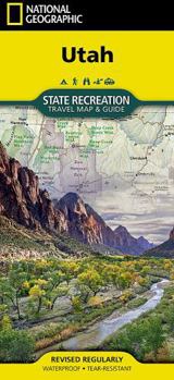
Utah State Recreation Map

- Waterproof - Tear-Resistant - Travel Map
Explore the dramatic beauty of the American Southwest with National Geographic's Utah State Recreation Travel Map & Guide. From towering red rock formations and desert canyons to alpine forests and winding scenic highways, this detailed recreation map is designed to help you make the most of every mile.
Whether you're visiting Utah's iconic national parks, searching for remote camping destinations, or planning an epic road trip, the map provides an easy-to-use regional layout packed with recreation opportunities and travel essentials.Discover hiking trails, rock climbing areas, off-road routes, wildlife viewing areas, water recreation sites, and breathtaking natural landmarks across the state.Shows public lands managed by national, state, and local agenciesIncludes road mileages and scenic routes for efficient travel planningProvides useful information on permits, passes, and campground reservationsHundreds of campgrounds mapped with amenities including reservable sites, RV facilities, group camping, and dump stationsDetailed Map of Zion National ParkA useful Mighty Five National Parks inset with descriptions of all five parksA comprehensive campground chart, organized by land management agency, makes it easy to compare camping options and choose the right basecamp for your adventure. Whether you're exploring canyon country, mountain trails, or quiet desert landscapes, the Utah State Recreation Travel Map & Guide is your trusted companion on the road.
Every State Recreation map is printed on "Travel-Tough" waterproof, tear-resistant paper.
Map Scale = 1:775,000Sheet Size = 37.75" x 25.5"Folded Size = 4.25" x 9.25"Recommended
Format: Loose Leaf
Condition: New

Related Subjects
TravelCustomer Reviews
ThriftBooks ® and the ThriftBooks ® logo are registered trademarks of Thrift Books Global, LLC