


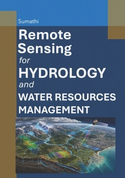
Remote Sensing for Hydrology and Water Resources Management
No Customer Reviews

Remote sensing has emerged as a transformative approach in the field of hydrology and water resources management, providing critical insights into the dynamic interactions within terrestrial and aquatic ecosystems. By harnessing electromagnetic energy across various wavelengths, remote sensing technologies enable the observation of hydrological processes at spatial and temporal scales that are often unattainable through traditional methods. The foundational principles of remote sensing encompass the interaction of electromagnetic energy with matter, which forms the basis for interpreting various environmental phenomena, including surface water dynamics, soil moisture variations, and evapotranspiration rates. The integration of remote sensing with hydrology facilitates a comprehensive understanding of water cycles and their components. This relationship is particularly significant in analyzing surface water and groundwater interactions, which are influenced by climatic conditions, land use, and human activities. Remote sensing provides valuable data on rainfall patterns, snow cover, and ice dynamics, allowing for improved modeling and forecasting of water availability and distribution. The ability to quantify these hydrological variables enhances decision-making processes in water resource management, especially in regions facing water scarcity or excess. Satellite data plays a pivotal role in gathering large-scale information essential for hydrological studies. Various satellite missions, equipped with optical, thermal, and microwave sensors, offer diverse datasets that capture critical hydrological indicators. For instance, optical sensors can assess vegetation health and land cover changes, while thermal sensors provide insights into surface temperature variations. Microwave remote sensing is particularly effective for measuring soil moisture and flood extents, making it an invaluable tool for monitoring water-related hazards. The continuous advancements in satellite technology and sensor capabilities further enhance the quality and resolution of hydrological data. Geographic Information Systems (GIS) serve as a powerful platform for integrating and analyzing remote sensing data within the context of hydrology. GIS facilitates the visualization of spatial patterns and relationships, enabling hydrologists to conduct watershed analysis and assess the impacts of land use changes on water resources. The combination of remote sensing and GIS allows for the development of comprehensive models that predict water availability, quality, and the potential effects of climate variability. This integrative approach is essential for effective water resource planning and management. Monitoring water quality and quantity is crucial for sustainable resource management, particularly in the face of increasing environmental pressures. Remote sensing technologies contribute significantly to assessing water quality parameters, such as turbidity, chlorophyll concentration, and temperature anomalies. By providing timely and spatially extensive data, remote sensing enhances the capacity to detect and respond to water quality issues, including pollution events and algal blooms. Furthermore, the ability to monitor floods and droughts through remote sensing improves resilience and preparedness, ultimately safeguarding communities and ecosystems.
Format:Paperback
Language:English
ISBN:B0HBKG1RD8
ISBN13:9798188951740
Release Date:July 2026
Publisher:Independently Published
Length:448 Pages
Weight:1.70 lbs.
Dimensions:0.9" x 7.0" x 10.0"
Customer Reviews
0 rating
Copyright © 2026 Thriftbooks.com
Terms of Use | Privacy Policy | Do Not Sell/Share My Personal Information | Cookie Policy | Cookie Preferences | Accessibility Statement
ThriftBooks ® and the ThriftBooks ® logo are registered trademarks of Thrift Books Global, LLC
ThriftBooks ® and the ThriftBooks ® logo are registered trademarks of Thrift Books Global, LLC
