
Lonely Planet Sydney City Map: Durable, Waterproof, Easy-Fold Planning Map with Attractions & Walking Tours
No Customer Reviews

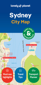
Experience your dream trip with Lonely Planet's Sydney City Map, the ultimate travel tool to help you plan and navigate your way around amazing local sights, landmarks and attractions.
Sail under Sydney Harbour Bridge, ride the waves at Bondi Beach, squeal at Luna Park's old-fashioned amusements, and decide where you want to go next and what you want to see in each of the city's exciting neighbourhoods.
Inside Lonely Planet's Sydney City Map:
Full colour map in a durable easy-fold formatSheet size: 24.8" (630mm) wide x 19.5" (494mm) high, folded size: 3.74" (95mm) wide x 7.76" (197mm) highWaterproof and packaged in a handy slipcaseAlphanumeric grid to find points of interest easilyPublic transport explained to help you get aroundTop picks of must-see highlights including Sydney Opera House, Taronga Zoo, and The RocksEssential travel tips and nuts and bolts information on how to speak like a local, the Opal card, and travelling to and from the airportBeautiful photography and bonus maps of Sydney Ferries Network and Sydney Trains NetworkCovers: Balgowlah Heights, Balmain, Balmain East, Balmoral, Bondi, Bronte, Castlecrag, Chatswood, Chinatown, Chippendale, City Centre, Cremorne, Crows Nest, Darling Harbour, Darlinghurst, Dawes Point, Double Bay, Dover Heights, East Sydney, Elizabeth Bay, Fairlight, Garden Island, Glebe, Haymarket, Kings Cross, Kirribilli, Manly, McMahons Point, Millers Point, Milsons Point, Moore Park, Mosman, Neutral Bay, North Sydney, Northbridge, Paddington, Point Piper, Potts Point, Pyrmont, Queens Park, Redfern, Rose Bay, Seaforth, Surry Hills, Sydney, The Rocks, Ultimo, Vaucluse, Watsons Bay, Willoughby, Woolloomooloo
Get ready for your next adventure with Lonely Planet's Sydney City Map, the ultimate navigation tool to help you explore Sydney's well-known attractions and best-kept secrets.
Format:Loose Leaf
Language:English
ISBN:1787017761
ISBN13:9781787017764
Release Date:September 2024
Publisher:Lonely Planet
Length:2 Pages
Weight:0.10 lbs.
Dimensions:0.5" x 3.9" x 7.7"
Recommended
Format: Loose Leaf
Condition: New
$8.33
Save $1.66!
List Price $9.99
On Backorder
If the item is not restocked at the end of 90 days, we will cancel your backorder and issue you a refund.
Usually restocks within 90 days
Not eligible for Free Shipping 
Save to List
Customer Reviews
0 rating
Copyright © 2026 Thriftbooks.com
Terms of Use | Privacy Policy | Do Not Sell/Share My Personal Information | Cookie Policy | Cookie Preferences | Accessibility Statement
ThriftBooks ® and the ThriftBooks ® logo are registered trademarks of Thrift Books Global, LLC
ThriftBooks ® and the ThriftBooks ® logo are registered trademarks of Thrift Books Global, LLC
