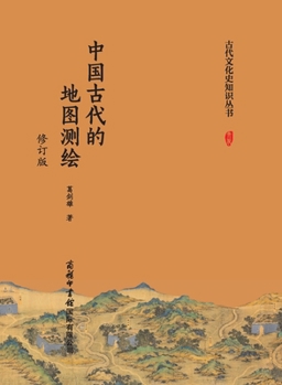
Ancient Chinese Cartography (Revised Edition)/中国古代的地图测绘(修订版 [Chinese]
No Customer Reviews

It chronicles the brilliant achievements of ancient Chinese cartography from antiquity to the present, and clarifies the developmental trajectory of mapmaking in ancient China. 历数从古至今中国古代地图测绘的光辉成就,厘清我国古代地图测绘的发展脉络。 Ancient Chinese cartography once set multiple world records. For example: the ancient map from the Warring States period unearthed at Fangmatan in Tianshui is the earliest surviving map in the world; the military map excavated from the Mawangdui Han Tombs in Changsha is the earliest known color military map in the world; the "Six Principles of Cartography" proposed by Pei Xiu represent the earliest theory of mapmaking in the world; and the three-dimensional map created by Shen Kuo in the late 11th century appeared more than 700 years earlier than similar maps in Europe. What enabled ancient Chinese cartography to achieve such a glorious record? This book chronicles the brilliant achievements of ancient Chinese cartography from antiquity to the present, and clarifies the developmental trajectory of mapmaking in ancient China, thereby offering readers a clear outline of the historical evolution of Chinese cartography. 中国古代的地图测绘曾经创造过多项世界记录,比如:天水放马滩出土的战国古地图是目前世界上最早的地图实物;长沙马王堆汉墓出土的驻军图是目前世界上最早的彩色军事地图;裴秀提出的"制图六体"是世界上最早的地图测绘理论;沈括在11世纪后期制作的立体地图比欧洲要早出现700多年......中国古代地图测绘为何会书写出如此多辉煌的篇章呢?该书历数从古至今中国古代地图测绘的光辉成就,厘清我国古代地图测绘的发展脉络,从而使读者了解我国地图历史发展的清晰轨迹。
Format:Paperback
Language:Chinese
ISBN:B0HK54RHYQ
ISBN13:9787517612056
Release Date:January 2026
Publisher:China National Publications Import & Export C
Length:162 Pages
Weight:0.50 lbs.
Dimensions:0.4" x 5.5" x 7.5"
Related Subjects
HistoryCustomer Reviews
0 rating
Copyright © 2026 Thriftbooks.com
Terms of Use | Privacy Policy | Do Not Sell/Share My Personal Information | Cookie Notice | Cookie Preferences | Accessibility Statement
ThriftBooks ® and the ThriftBooks ® logo are registered trademarks of Thrift Books Global, LLC
ThriftBooks ® and the ThriftBooks ® logo are registered trademarks of Thrift Books Global, LLC