
World Wall Laminated Map
No Customer Reviews

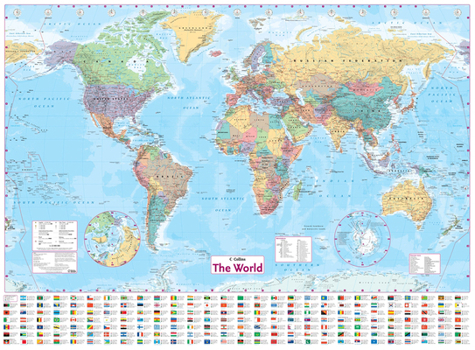
This laminated World Map has been fully updated to include the latest political changes, and contains politically colored mapping showing each country and their capital city, major roads, railways, and cities and towns clearly. Also included are national flags, key statistics for every country, and inset maps of the polar regions. This laminated (on front side only) map is ideal for any classroom, bedroom, or office wall. INCLUDES:
- All recent political changes including the new independent country of South Sudan
- Changes to international dateline AREA OF COVERAGE
All of the world, centered on the Greenwich Meridian, and including maps of the North and South Pole regions. SCALE
1:22 000 000; 1 cm to 220 km; 1 inch to 347 miles SIZE
54 x 40 inches OTHER VERSIONS AVAILABLE
Paper flat map in tube (ISBN 9780007493111).
Format:Misc.
Language:English
ISBN:000749310X
ISBN13:9780007493104
Release Date:August 2013
Publisher:Collins Geo
Length:1 Pages
Weight:0.66 lbs.
Dimensions:2.0" x 2.0" x 41.8"
Customer Reviews
0 rating
Copyright © 2026 Thriftbooks.com Terms of Use
| Privacy Policy | Do Not
Sell/Share My Personal Information | Cookie Policy | Cookie Preferences | Accessibility Statement
ThriftBooks® and the ThriftBooks® logo are registered trademarks of Thrift Books Global, LLC
ThriftBooks® and the ThriftBooks® logo are registered trademarks of Thrift Books Global, LLC
