
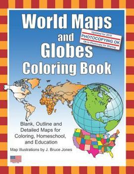
World Maps and Globes Coloring Book: Blank, Outline and Detailed Maps for Coloring, Home School and Education

Black outline, blank maps included in the book are:
- World Maps - Mercator Projections, including maps with individual countries
- World Maps - Robinson Projections, including maps with individual countries- Sinusoidal 6 point World Projection Map, this is the orange peel one
- United States Outline Maps, with and without names
- Canada Maps, with and without names
- Maps of North America including Canada, USA and Mexico, with and without names
Also lots of Globe Maps with continents to color: North & South America, Europe, North America, South India Ocean, South America, Pacific Ocean, Middle East, Japan & Pacific Ocean, India & Asia, Australia, Africa, North Pole and the South Pole.
Plus a set of 12 Globes that are turned every 30 degrees. A great collection to get your student or child into learning about the world.
The printable, blank, outline maps in this coloring book can be freely photocopied by a teacher or parent for use in a classroom or for home school lessons.
Customer Reviews
ThriftBooks ® and the ThriftBooks ® logo are registered trademarks of Thrift Books Global, LLC
