
Wenatchee, Wa No. 211s
No Customer Reviews

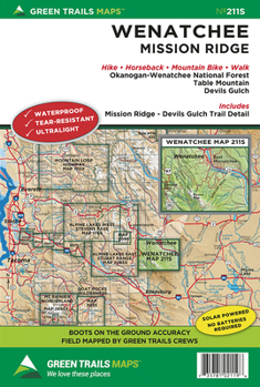
Mission Ridge rises more than 6,000 feet above the city of Wenatchee on the Columbia River. Far enough east to be within the Cascade rain shadow and high enough to receive ample snowfall, Mission Ridge offers superb skiing opportunities. Our 211S map provides detailed coverage of the system of roads and trails doubling as backcountry skiing, snowshoeing, and snowmobile routes. Mission Ridge is also known for its excellent mountain biking and horseback riding trails. This map covers The Devils Gulch trail system, Tronsen Ridge, Table Mountain and Blewett Pass. Map also covers the northern half of the Colockum Wildlife Area, the Foothills Trails, and other community trails within and near Wenatchee. Map also includes a close-up (1:24,000 scale) of the Devils Gulch Mission Ridge Trail network. 1:69500 Wenatchee Map, 1:24000 Mission Ridge Devils Gulch detailed Inset. Printed on a rugged Waterproof - Tear Resistant Sheet. Reprinted 2023br>
Map Scale 1:69,500 with 1:24000 inset of Mission Ridge / Devils Gulch
Map Scale 1:69,500 with 1:24000 inset of Mission Ridge / Devils Gulch
Format:Loose Leaf
Language:English
ISBN:1680515055
ISBN13:9781680515053
Release Date:July 2021
Publisher:Green Trails Maps
Length:2 Pages
Weight:0.05 lbs.
Dimensions:0.0" x 5.8" x 8.8"
Recommended
Format: Loose Leaf
Condition: New
$10.99
Save $3.01!
List Price $14.00
On Backorder
If the item is not restocked at the end of 90 days, we will cancel your backorder and issue you a refund.
Usually restocks within 90 days
Not eligible for Free Shipping 
Save to List
Related Subjects
TravelCustomer Reviews
0 rating
Copyright © 2026 Thriftbooks.com Terms of Use
| Privacy Policy | Do Not
Sell/Share My Personal Information | Cookie Policy | Cookie Preferences | Accessibility Statement
ThriftBooks® and the ThriftBooks® logo are registered trademarks of Thrift Books Global, LLC
ThriftBooks® and the ThriftBooks® logo are registered trademarks of Thrift Books Global, LLC
