
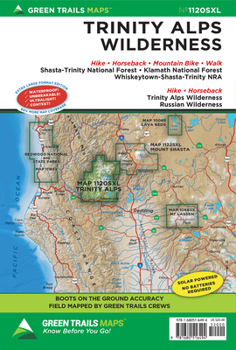
Trinity Alps Wlderness, CA No. 1120sxl
No Customer Reviews

Extra-large 22.5 x 36 unfolded (shipped folded, 6 x 9) waterproof, tear resistant, ultralight map printed on Polyart. Areas covered:
Shasta-Trinity National Forest Klamath National Forest Whiskeytown-Shasta-Trinity NRA Trinity Alps Wilderness Russian Wilderness As every experienced backcountry adventurer knows, possessing solid tools for navigation is one of the Ten Essentials for a safe adventure. There are, of course, many technological options out there, but to truly be prepared there's really nothing better than a paper map--and there's absolutely no better map than a color topographic Green Trails map. Fully vetted and high quality, Green Trails maps are not only useful for trip planning but will keep backcountry travelers on track, long after the batteries have died on other navigational devices.Context counts Each map includes: Trails coded for hikers only, as well as mountain bikers, stock, skiers, and snowmobilers Icons for parking and picnic areas, tent camping and RV spaces, bathrooms and backcountry toilets, points of interest, waterfalls, springs, and gates Dot-to-dot trail distances, contour intervals, adjacent map numbers, and permits required Land designations: national and state parks, national forest, wilderness, DNR land, private land, tribal land, and others
Map Scale: 1:63360
Format:Loose Leaf
Language:English
ISBN:1680516493
ISBN13:9781680516494
Release Date:July 2024
Publisher:Green Trails Maps
Length:2 Pages
Weight:0.20 lbs.
Dimensions:0.4" x 5.8" x 8.8"
Recommended
Format: Loose Leaf
Condition: New
$14.80
Save $5.20!
List Price $20.00
On Backorder
If the item is not restocked at the end of 90 days, we will cancel your backorder and issue you a refund.
Usually restocks within 90 days
Not eligible for Free Shipping 
Save to List
Related Subjects
TravelCustomer Reviews
0 rating
Copyright © 2026 Thriftbooks.com Terms of Use
| Privacy Policy | Do Not
Sell/Share My Personal Information | Cookie Policy | Cookie Preferences | Accessibility Statement
ThriftBooks® and the ThriftBooks® logo are registered trademarks of Thrift Books Global, LLC
ThriftBooks® and the ThriftBooks® logo are registered trademarks of Thrift Books Global, LLC
