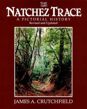
The Natchez Trace: A Pictorial History
Select Format
Select Condition 
Book Overview
"An accurate and authentic account of the entire 10,000 years of... the Old Natchez Trace and the modern parkway." - John Mohlhenrich, former Chief Park Interpreter of the Natchez Trace Parkway.... This description may be from another edition of this product.
Format:Paperback
Language:English
ISBN:0934395039
ISBN13:9780934395038
Release Date:January 1985
Publisher:Thomas Nelson
Length:160 Pages
Weight:0.95 lbs.
Dimensions:0.5" x 8.1" x 10.0"
Customer Reviews
3 ratings
Drive with history and perhaps a ghost or two
Published by Thriftbooks.com User , 16 years ago
A few years ago I made this trip along the Natchez Trace Parkway from end to end in an automobile, stopping at one restored stand and the official Tourist Visitor Center in Tupelo, where I bought "The Natchez Trace: A Pictorial History" and picked up a copy of the fold-out of the "Official Map and Guide." It is a backwards way of doing things--to buy the book then read about the place after you've been there, but if you don't know you're going to make the trip until you are there, kind of happenstance, then you cannot plan ahead. We found ourselves outside Nashville at the beginning of the Natchez Trace Parkway and said, Why not? Instead of the mad drive down an interstate, we set a leisurely pace down this scenic, national, historic parkway. According to Congress, "This roadway, following the historic Trace for 450 miles, will ensure a continuously unfolding inspirational interpretation of an important transportation route and its related regional resources which opened the way to expansion of the United States into the Old Southwest" (7). The Trace and Parkway offer a larger variety of scenery than any other place in the country as it passes through three regions of topography: Highland Rim, Northeast Hills, and Tombigbee Prairie. It also links three riverways: Cumberland, Tennesse, and Mississippi Rivers. "At least 100 species of trees, 215 species of birdlife, 57 species of mammals, and 89 species of reptiles and amphibians reside along today's Natchez Trace Parkway" (9). Buffalo probably were the first natural travelers along the Trace, making their way from south to the salt licks of the northern area. Indians, then explorers, then colonists making their way from one area to the other entrenched the Trace into a permanent trail. (Trace refers to the trail, Parkway is the national roadway.) Early traveler stops, called stands, are described in documents as sometimes inhospitable. Intending to supplement their income, some farmers opened stands offering a bed, food, and shelter. These were found a day's travel apart. Some, however, were hovels with dirt floors, no walls, and a bearskin to sleep on. The restored stand actually offered a room with "family-style" dining--food piled on a table with a help-yourself service. Today the map shows hiking trails, horse riding trails, picnic areas, historic areas to visit (Indian mounds, Old Trace exhibits), and nature trails. Sanitary stations and public campgrounds are also interspersed for public use. One historic site marks the place where Meriwether Lewis, of the Lewis and Clark expedition, and one-time governor of the Louisiana Territory, was shot. The first statement in the Map and Guide is this: "This is the story of human beings on the move, of the age-old need to get from one place to another." Even today when hurry and hurry faster are the dominant mode of travel, there is a place designed to slow us and make us observe the beauty of nature and history as they combine.
A Pictorial History of a Scenic Parkway
Published by Thriftbooks.com User , 20 years ago
The Natchez Trace was once a 450 mile highway across a part of the US running from Nashville, Tenn to Natchez, Ms. Before 1820 it was known as the "Path to the Choctow Nation." The French included the Trace in their maps as early as 1733, and many thousands of travelers used it in its heyday from the 1780's to the 1810's. In 1811 the Roosevelts "plied down the Ohio and the Mississippi Rivers from Pittsburg to New Orleans" aboard another piece of Americana, the river boat. In the 1820's the Natchez Trace saw a last hurrah when Andrew Jackson's Military road cut the overland distance to New Orleans by over 200 miles. The Trace had become obselete.In the 1930's the Natchez Trace Parkway was begun to allow travelers to follow the old Trace from end to end. The Parkway is almost complete now. There are a few miles near Natchez and Jackson where the Parkway has not been completed, but otherwise the Parkway and the Trace are now known as one and the same. The Parkway is a scenic route. My wife and I traveled the Parkway and reveled in the gorgeous sites. Is there a better way to remember such sites than with a pictorial history? I think not.
Excellent guide to the Trace
Published by Thriftbooks.com User , 24 years ago
We are quasi freqent travelers of The Natchez Trace and have always loved stopping to learn, as we drove this beautiful parkway. We have had several guides, but none come close to the scope of this book. From ancient peoples, up to recent developments along the Trace, this is an easy to read, yet comprehensive history. I highly recommend you take it along as you drive the Trace, I intend to do that very thing later this summer!


