


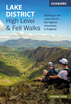
Lake District: High Level and Fell Walks: Walking in the Lake District - The Highest Mountains in England

Discover the Lake District's wild heights and thrilling ridges with 30 of the finest high-level and fell walks in this celebrated National Park and UNESCO World Heritage Site. From the lofty summits of Scafell Pike and Helvellyn to the classic horseshoe circuits of Fairfield and Kentmere, explore the region's most dramatic peaks, airy ridges, and remote fells on routes designed to showcase the very best of Lakeland mountain walking.
Ideal for experienced walkers and those keen to progress to higher ground, this comprehensive Cicerone guidebook highlights a range of high level Lake District routes from 7 to 24km (4-15 miles) in length, graded from one (easiest) to five, ensuring options for all abilities. Most walks are circular, with a few linear routes making use of the area's excellent public transport links. Whether you're seeking an exhilarating scramble, a classic summit day, or a quieter alternative to the popular peaks, you'll find inspiration and challenge in equal measure.
The walks are grouped into six regional sections: Keswick; Borrowdale and Buttermere; the Western Valleys; Coniston and Langdale; Ambleside, Grasmere and Windermere; and Ullswater. Together, they cover the full breadth of the Lake District National Park's mountain landscape.Experience a variety of high level Lake District terrains, from well-made paths to airy ridges and open fell, with some routes featuring easy scrambling for added excitement.Tackle legendary fells and classic rounds, including Scafell Pike, Helvellyn, Skiddaw, the Newlands Round, and the Coledale, Fairfield and Kentmere horseshoes, as well as lesser-known gems like Martindale and Deepdale.Each route description includes comprehensive details to help you plan your high level Lakeland fell adventure: start/finish points, distance, total ascent, grade, estimated time, terrain, required maps, refreshment stops, and public transport options.Map extracts are taken from Ordnance Survey(R) 1:50,000 Landranger(R) series, providing detailed navigation for high-level fell walks throughout the Lake District. Free GPX tracks are available for download, and a comprehensive route summary table helps you plan your Lake District adventures.Also available from Cicerone: Lake District Low Level and Lake Walks.Plan your Lake District high level and fell walks with Cicerone's essential guidebook, your key to scaling iconic peaks, traversing dramatic ridges, discovering secret tarns, and experiencing the full majesty of England's finest mountain landscape.
Customer Reviews
ThriftBooks ® and the ThriftBooks ® logo are registered trademarks of Thrift Books Global, LLC
