

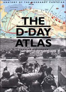
The D-Day Atlas: Anatomy of the Normandy Campaign


Select Format
Select Condition 
Book Overview
June 2004 marks the sixtieth anniversary of the largest amphibious military operation in history. D-Day was the culmination of four years of planning and preparation, which had begun in summer 1940... This description may be from another edition of this product.
Format:Hardcover
Language:English
ISBN:0500251231
ISBN13:9780500251232
Release Date:April 2004
Publisher:Thames & Hudson
Length:176 Pages
Weight:2.60 lbs.
Dimensions:0.9" x 8.9" x 11.8"
Customer Reviews
5 ratings
Great Color Maps
Published by Thriftbooks.com User , 15 years ago
The book is almost 12 in by 9 in and most of the 71 maps are large with good detail and are easy to understand. The coverage starts before the landing and contains 14 Allied related maps and five maps dealing with German dispositions. The atlas then runs through the major offensives of Normandy through mid September when Montgomery reaches the Netherlands border, Patton reaches Metz and Nancy and Devers is approaching Belfort. The third chapter covers only D-Day landings and contains 13 maps. After D-Day, the Cherbourg liberation, the fall of St Lo, Operation Cobra, Epsom, Charnwood, Goodwood, the Mortain counter offensive, Operation Bluecoat, Totalize, Tractable, and a nice sequence in closing the Falaise pocket are covered. Scattered throughout these specific maps are Situation maps showing Allied progress. There is a running dialog that describes the action that is represented on each map. The overview is sufficient but I would have preferred greater depth of the action but perhaps its not in the purview of the publisher to do so. (That's the reason for 4 stars; the maps are 5 star quality. I study these maps quite often when reading other books on Normandy.) Besides the excellent maps, there are many illustrations, sidebars and photos that will peak your interest as well. The Table of Contents is comprehensive and makes your job easy finding what you need. The index is also well done. There is a section that include "Codewords" which is interesting; it describes what each Codeword operation covers. Another section lists the units on both sides that were fighting in France. If your looking for great, useful maps of France, give this book serious consideration. If your interested in useful maps of the entire war, including the Pacific and China try Mr Messenger's "The Chronological Atlas of World War Two".
Highly recommended
Published by Thriftbooks.com User , 16 years ago
I bought the Atlas so I could visually follow along with a Book on CD I was listening to regarding the landings (I forget which title..prolly Keegan's book) and it was the perfect match. I am now looking for a similar atlas to use as I listen to Atkinson's latest Army at Dawn book. I highly recommend this book if you are interested in some of the finer details surrounding the landings and want to visualize the battlefield from a strategic point of view.
the d-day atlas
Published by Thriftbooks.com User , 17 years ago
great book. good maps & pictures.not as detailed as some other d-day books i have but maps are very good.great add on to other d-day volumes in your library. recomended!
The perfect guide for touring the Normandy battlefields
Published by Thriftbooks.com User , 17 years ago
I used this book as my bible during a multi-day tour of the Normandy battlefields. The level of detail and first rate analysis really set this book apart. I carried this book the entire time I was in Northern France and referred to it constantly. The maps as some of the most beautiful historical maps I have ever seen. They are clear, well designed, and contain a wealth of information. The level of detail is down to small roads and individual building in many maps. So many military history books skimp on maps. The full-color works of art in this book are almost worthy of framing. The author provides great commentary on the strategy and tactics of the invasion. Crisp line drawings of important weaponry are used throughout the book. I wish every major historical battlefield had such a great guide.
As the Title Projects
Published by Thriftbooks.com User , 18 years ago
Messenger's D-Day Atlas has many maps that are very easily read and the text within the book itself is very well written. If you are looking for a good overview of the invasion and it's aftermath, complete with anecdotes and easy to follow maps, then this is a book that you should be happy with.
Copyright © 2023 Thriftbooks.com Terms of Use | Privacy Policy | Do Not Sell/Share My Personal Information | Cookie Policy | Cookie Preferences | Accessibility Statement
ThriftBooks® and the ThriftBooks® logo are registered trademarks of Thrift Books Global, LLC
ThriftBooks® and the ThriftBooks® logo are registered trademarks of Thrift Books Global, LLC
