

Texas Land Survey Maps for Foard County
No Customer Reviews

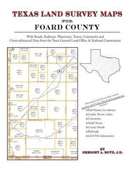
190 pages with 49 maps An indispensable book for any researcher interested in Foard County's history or land (or both), or its first landowners after Texas's Independence from Mexico. Each book in... This description may be from another edition of this product.
Format:Paperback
Language:English
ISBN:1420350528
ISBN13:9781420350524
Release Date:May 2010
Publisher:Arphax Publishing Co.
Length:200 Pages
Weight:1.05 lbs.
Dimensions:0.4" x 8.5" x 11.0"
Related Subjects
ReferenceCustomer Reviews
0 rating
Copyright © 2023 Thriftbooks.com Terms of Use | Privacy Policy | Do Not Sell/Share My Personal Information | Cookie Policy | Cookie Preferences | Accessibility Statement
ThriftBooks® and the ThriftBooks® logo are registered trademarks of Thrift Books Global, LLC
ThriftBooks® and the ThriftBooks® logo are registered trademarks of Thrift Books Global, LLC
