
National Geographic South America and Antarctica Map (Folded with Flags and Facts)
No Customer Reviews

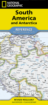
- Waterproof - Tear-Resistant - Reference Map
Expertly researched and designed, National Geographic's South America and Antarctica Flags & Facts Map is the authoritative map of South America by which other reference maps are measured. The map side includeds a political map showing countries, cities and other landmarks and a physical map shows the landforms such as mountain ranges and rivers. The Flags & Facts side includes a combined political and physical map of Antarctica.
Clearly defined boundaries, major cities, and physical featuresHundreds of place names carefully placed to maintain legibility in heavily populated areasIncludes South America and Antarctica and adjacent regions within North AmericaDetailed physical map of South America with mountain ranges, plains, lakes, and riversFlags and facts with detailed information about cultural and physcial attributesPrinted in the U.S.A. on extremely durable, waterproof, and tear-resistant materialThis Reference Map is printed on durable synthetic paper, making it waterproof, tear-resistant and tough -- capable of withstanding the rigors of any kind of use in the home or classroom.
Sheet Size = 18.5" x 25.25"Folded Size = 4.25" x 9.25"Format:Misc.
Language:English
ISBN:1566959349
ISBN13:9781566959346
Release Date:May 2023
Publisher:National Geographic Maps
Length:2 Pages
Weight:0.20 lbs.
Dimensions:0.2" x 4.2" x 9.4"
Recommended
Format: Misc.
Condition: New
$11.53
Save $3.42!
List Price $14.95
On Backorder
If the item is not restocked at the end of 90 days, we will cancel your backorder and issue you a refund.
Usually restocks within 90 days
Not eligible for Free Shipping 
Save to List
Customer Reviews
0 rating
Copyright © 2026 Thriftbooks.com
Terms of Use | Privacy Policy | Do Not Sell/Share My Personal Information | Cookie Policy | Cookie Preferences | Accessibility Statement
ThriftBooks ® and the ThriftBooks ® logo are registered trademarks of Thrift Books Global, LLC
ThriftBooks ® and the ThriftBooks ® logo are registered trademarks of Thrift Books Global, LLC
