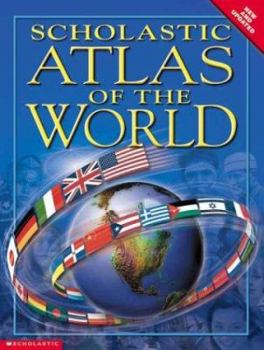
Scholastic Atlas of the World
With more photos, maps, and graphics than the leading competition, the SCHOLASTIC ATLAS OF THE WORLD is now available in paperback. This is a must-have for every home, library, and classroom. With... This description may be from another edition of this product.
Format:Paperback
Language:English
ISBN:043952797X
ISBN13:9780439527972
Release Date:June 2003
Publisher:Scholastic Reference
Length:224 Pages
Weight:1.45 lbs.
Dimensions:0.5" x 8.5" x 11.2"
Age Range:9 years and up
Grade Range:Grade 4 and higher
Customer Reviews
4 ratings
Fabulous, entrancing reference title
Published by Thriftbooks.com User , 14 years ago
It's that time of year, school is back in session, things are rolling along well -- then suddenly you realize that your child's hand-me-down atlas is sadly outdated. Perhaps we're the only family with antiquated student atlases on the shelf with outdated political boundaries, but our latest reference title far surpasses our antiquated student atlas. The Scholastic Canada Atlas of the World is a beautiful beginner's reference, perfect for children ready to dig into some more substantive geographic and cultural facts than are included in the simplest primer-style atlases. Filled with gorgeous, full colour photography, vivid maps, and a wide range of geographic details, this title brings the study of place and people to life. Opening with an introduction to the making of maps, using maps, the solar system, time zones, tectonic plates, oceans, climate, the water cycle, natural resources and much more -- this wealth of information provides a rich fount to draw general knowledge from in addition to the splendid maps. Like all atlases this information is written from an old-earth perspective. Divided into seven continental regions: North America, South America, Europe, Asia, Africa, Oceania, and Antarctica, each region is colour coded. All of the North American pages (Canada and the U.S. receive several two-page spreads each) are backed by a pastel lilac, the South American pages a pastel peach, and so on. Each included country features a cultural and geographic overview that includes climate, economy and more, with fact boxes including: highest mountains, longest rivers, flags, life facts, trivia, time zones, latitude and longitude, and demographics. A search and find box provides cities of note and their alphanumeric reference (corresponding to a grid surrounding the page border) B5, for example is a "latitude" of B, and a "longitude" of 5 within that specific map. As the maps are all scaled separately, each includes it's own scale and compass rose. Pictures of the country's people and well known places bring the region to life, while the life facts box which compares and contrasts life span and how many people in 100 own cars of the target country with Canada -- or the US in the American edition Scholastic Atlas of the World. Smaller countries sharing borders may share a two-page spread, such as North and South Korea, Iraq and Iran, or the Ukraine, Belarus, and Moldova. Due to the unique two-page spread design, the country maps are placed dead center with fact boxes, text and photographs ringing the map. In a few cases this results in the obfuscation of parts of the letters making up place names, but they are still readable with a bit of squinting and page pushing. What has endeared me to this atlas above others is the inherent appeal it holds for my children. It invites browsing, and I've seen my six-year-old lying on the floor just taking in the photos, the maps, and the people. I've had to pry her away from its pages on more than one occasi
Aside from the map issue, a mediocre student atlas
Published by Thriftbooks.com User , 16 years ago
I chose this atlas out of a selection at Borders, for my middle-school-age child. We had purchased the Rand McNally "intermediate" atlas, which was supposedly for ages 9 and up, but it was too simplistic. This atlas provides a lot more information for the money. The maps definitely have an issue; too much is lost in the binding area. Aside from that, this seems to be a nice student atlas for basic project work -- by basic, I mean it is geared more towards continents and regions. If you want information about specific countries, which seems to me an obvious thing for an atlas to have, you will need to look elsewhere. Too bad!!
The best atlas on earth forever!
Published by Thriftbooks.com User , 18 years ago
This atlas I got from my aunt and uncle as a present.Its a fun way to learn about the earth and all the countries and continents.this atlas would be great for you!If you are looking for an atlas get this one!It is my favorite atlas!
A Great Kid's Atlas!
Published by Thriftbooks.com User , 22 years ago
This is a wonderful Atlas for an elementary school aged child. It lists languages, currency, religion, population, etc etc for each country clearly. Great information on rivers and mountains as well. Colorful, clearly displayed information makes it easy to use. My son reads atlas this for fun!


