
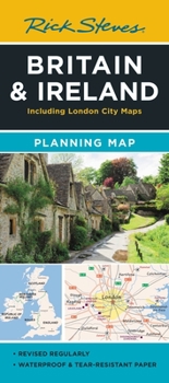
Rick Steves Britain & Ireland Planning Map: Including London City Map
No Customer Reviews

Designed for Rick Steves fans, this map highlights Great Britain and Ireland's best destinations in a colorful, easy-to-use format on high-quality paper:
Cuts the Clutter: While big cities are included for navigational purposes, this map focuses on Rick's favorite spots for travelers Guidebook-Friendly: At a glance, all the places you read about in Rick Steves' guidebooks stand out in a crisp, easy-to-read format Durable Construction: This map is printed on tearproof paper to last over many trips Road or Sea: Includes highways, ferry routes, bus stops, and train lines for easy route-planning The Back's Even Better: The reverse side includes a detailed city-center map of London locating sights, hotels, and restaurantsFormat:Loose Leaf
Language:English
ISBN:1641715952
ISBN13:9781641715959
Release Date:April 2024
Publisher:Rick Steves
Length:2 Pages
Weight:0.12 lbs.
Dimensions:0.2" x 4.3" x 9.3"
Recommended
Format: Loose Leaf
Condition: New
$8.33
Save $1.66!
List Price $9.99
Almost Gone, Only 3 Left!
Ships within 24 hours
Not eligible for Free Shipping 
Save to List
Related Subjects
TravelCustomer Reviews
0 rating
Copyright © 2026 Thriftbooks.com
Terms of Use | Privacy Policy | Do Not Sell/Share My Personal Information | Cookie Policy | Cookie Preferences | Accessibility Statement
ThriftBooks ® and the ThriftBooks ® logo are registered trademarks of Thrift Books Global, LLC
ThriftBooks ® and the ThriftBooks ® logo are registered trademarks of Thrift Books Global, LLC
