
Rand McNally Greater Boston Eastern Massachusetts Regional Map
No Customer Reviews

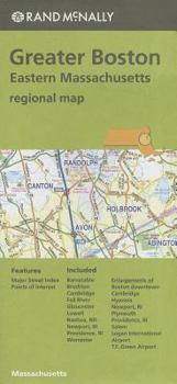
Rand McNally's folded map for Greater Boston Eastern Massachusetts is a must-have for anyone traveling in and around the Greater Boston Eastern Massachusetts area, offering unbeatable accuracy and reliability at a great price. Our trusted cartography shows all Interstate, U.S., state, and county highways, along with clearly indicated parks, points of interest, airports, county boundaries, and streets. The easy-to-use legend and detailed index make for quick and easy location of destinations. You'll see why Rand McNally folded maps have been the trusted standard for years.
Folded map features:
Regularly updated
Full-color maps
Clearly labeled Interstate, U.S., state, and county highways
Indications of parks, points of interest, airports, county boundaries, downtown & vicinity maps
Easy-to-use legend
Convenient folded size
Additional Features:
Major Street Index
Points of Interest
Enlargements of Boston downtown, Cambridge, Hyannis, Newport, RI, Plymouth, Providence, RI, Salem, Logan In
Format:Map
Language:English
ISBN:0528008927
ISBN13:9780528008924
Release Date:June 2017
Publisher:Rand McNally
Weight:0.15 lbs.
Dimensions:0.5" x 4.1" x 9.0"
Related Subjects
TravelCustomer Reviews
0 rating
Copyright © 2026 Thriftbooks.com
Terms of Use | Privacy Policy | Do Not Sell/Share My Personal Information | Cookie Policy | Cookie Preferences | Accessibility Statement
ThriftBooks ® and the ThriftBooks ® logo are registered trademarks of Thrift Books Global, LLC
ThriftBooks ® and the ThriftBooks ® logo are registered trademarks of Thrift Books Global, LLC
