
Rand McNally Folded Map: San Antonio Street Map
No Customer Reviews

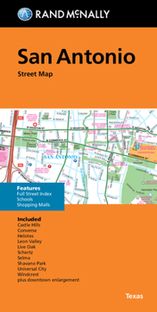
Rand McNally's folded map for San Antonio is a must-have for anyone traveling in and around this part of Texas, offering unbeatable accuracy and reliability at a great price. Our trusted cartography shows all Interstate, U.S., state, and county highways, along with clearly indicated parks, points of interest, airports, county boundaries, and streets. The easy-to-use legend and detailed index make for quick and easy location of destinations. You'll see why Rand McNally folded maps have been the trusted standard for years. - Regularly updated. - Full-color maps. - Clearly labeled Interstate, U.S., state, and county highways. - Indications of parks, points of interest, airports, county boundaries, schools, shopping malls, downtown & vicinity maps. - Enlargements of downtown. - Easy-to-use legend. - Detailed index & full street index. - Convenient folded size. Coverage Area Communities Included: Alamo Heights, Balcones Heights, Castle, Hills, Fort Sam Houston, Hill Country Village, Hollywood Park, Kirby, Lackland Air Force Base, Leon Valley, Olmos Park, Shavano Park, Terrel Hills, Windcrest, and downtown enlargement. Product Details: Measures 9.5' x 4' and folds out to 40' x 28'.
Format:Loose Leaf
Language:English
ISBN:0528027336
ISBN13:9780528027338
Release Date:May 2023
Publisher:Rand McNally
Length:1 Pages
Related Subjects
ReferenceCustomer Reviews
0 rating
Copyright © 2026 Thriftbooks.com
Terms of Use | Privacy Policy | Do Not Sell/Share My Personal Information | Cookie Policy | Cookie Preferences | Accessibility Statement
ThriftBooks ® and the ThriftBooks ® logo are registered trademarks of Thrift Books Global, LLC
ThriftBooks ® and the ThriftBooks ® logo are registered trademarks of Thrift Books Global, LLC
