
Rand McNally Folded Map: Northern Virginia Street Map
No Customer Reviews

Select Format
Select Condition 
Recommended
Format: Loose Leaf
Condition: New
$8.39
Save $1.60!
List Price $9.99
On Backorder
If the item is not restocked at the end of 90 days, we will cancel your backorder and issue you a refund.
Usually restocks within 90 days
Not eligible for Free Shipping
Book Overview
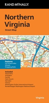
Rand McNally's folded map featuring the streets of Northern Virginia is a must-have for anyone traveling in and around this part of Virginia and Maryland, offering unbeatable accuracy and reliability at a great price. Our trusted cartography shows all Interstate, U.S., state, and county highways, along with many smaller roads and streets, too. You'll see why Rand McNally folded maps have been the trusted standard for years. - Regularly updated, full-color maps. - Clearly labeled Interstate, U.S., state, and county highways. - One-way streets indicated. - Indications of county boundaries, schools, shopping malls, parks, golf courses, hospitals, airports, and points of interest. - Easy-to-use legend. - Detailed street index. - Compact folded size. Coverage Area Communities include: Alexandria, Arlington, Fairfax, Falls Church, Herndon. Product Details Measures 9.5" x 4" and folds out to 40" x 28".
Format:Loose Leaf
Language:English
ISBN:0528029118
ISBN13:9780528029110
Release Date:October 2024
Publisher:Rand McNally
Weight:0.05 lbs.
Dimensions:0.3" x 4.0" x 9.2"
Related Subjects
ReferenceCustomer Reviews
0 rating
Copyright © 2025 Thriftbooks.com
Terms of Use | Privacy Policy | Do Not Sell/Share My Personal Information | Cookie Policy | Cookie Preferences | Accessibility Statement
ThriftBooks ® and the ThriftBooks ® logo are registered trademarks of Thrift Books Global, LLC
ThriftBooks ® and the ThriftBooks ® logo are registered trademarks of Thrift Books Global, LLC
