
Rand McNally Easy to Read: North Carolina State Folded Map
No Customer Reviews

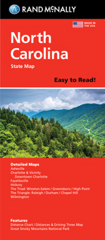
Rand McNally's folded map for North Carolina is a must-have for anyone traveling in or through the state, offering unbeatable accuracy and reliability at a great price. Our trusted cartography shows all Interstate, U.S., state, and county highways and much more. - Points of interest. - State park chart. - State mileage chart. - Driving times map. - On-the-road toolbox. - Visitor center information. - Climate data. - State facts & symbols. - Easy-to-use legend. - Detailed indexed. Coverage Area Detailed maps include: Asheville, Charlotte, Fayetteville, Gastonia, Great Smoky Mountains National Park, Raleigh/Durham/Chapel Hill, Wilmington, Winston-Salem/Greensboro/High Point. Product Details: Measures 4" x 9.5" and folds out to 28" x 40".
Format:Loose Leaf
Language:English
ISBN:052802910X
ISBN13:9780528029103
Release Date:February 2024
Publisher:Rand McNally
Length:1 Pages
Weight:1.00 lbs.
Dimensions:0.2" x 3.9" x 9.3"
Recommended
Format: Loose Leaf
Condition: New
$8.83
Save $1.16!
List Price $9.99
Ships within 24 hours
Not eligible for Free Shipping 
Save to List
Related Subjects
ReferenceCustomer Reviews
0 rating
Copyright © 2026 Thriftbooks.com
Terms of Use | Privacy Policy | Do Not Sell/Share My Personal Information | Cookie Policy | Cookie Preferences | Accessibility Statement
ThriftBooks ® and the ThriftBooks ® logo are registered trademarks of Thrift Books Global, LLC
ThriftBooks ® and the ThriftBooks ® logo are registered trademarks of Thrift Books Global, LLC
