


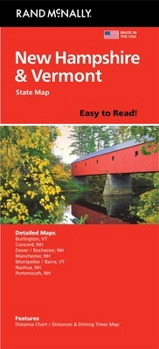
Rand McNally Easy to Read: New Hampshire, Vermont
No Customer Reviews

Rand McNally's Easy To Read State Folded Map is a must-have for anyone traveling in and around New Hampshire and Vermont, offering unbeatable accuracy and reliability at a great price. Our trusted cartography shows all Interstate, U.S., state, and county highways, along with clearly indicated parks, points of interest, airports, county boundaries, and streets. The easy-to-use legend and detailed index make for quick and easy location of destinations. You'll see why Rand McNally folded maps have been the trusted standard for years. - Regularly updated, full-color maps. - 53% larger map with a bigger type size than the Rand McNally Folded Map. - Clearly labeled Interstate, U.S., state, and county highways. - Indications of parks, points of interest, airports, county boundaries, and more. - Mileage and driving times map. - Convenient folded size. Coverage Area Detailed maps of: Burlington, VT; Concord, NH; Manchester, NH; Montpelier/Barre, VT; Nashua, NH; Portsmouth, NH; Rochester, NH. Product Details: Dimensions (unfolded): 28" x 40".
Format:Loose Leaf
Language:English
ISBN:0528029037
ISBN13:9780528029035
Release Date:June 2024
Publisher:Rand McNally
Weight:0.30 lbs.
Dimensions:0.5" x 4.1" x 9.0"
Recommended
Format: Loose Leaf
Condition: New
$7.73
Save $2.26!
List Price $9.99
Only 9 Left
Ships within 24 hours
Not eligible for Free Shipping 
Save to List
Related Subjects
ReferenceCustomer Reviews
0 rating
Copyright © 2026 Thriftbooks.com
Terms of Use | Privacy Policy | Do Not Sell/Share My Personal Information | Cookie Policy | Cookie Preferences | Accessibility Statement
ThriftBooks ® and the ThriftBooks ® logo are registered trademarks of Thrift Books Global, LLC
ThriftBooks ® and the ThriftBooks ® logo are registered trademarks of Thrift Books Global, LLC
