


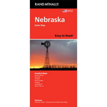
Rand McNally Easy to Read: Nebraska State Map
No Customer Reviews

Rand McNally's Easy To Read State Folded Map is a must-have for anyone traveling in and around Nebraska, offering unbeatable accuracy and reliability at a great price. Our trusted cartography shows all Interstate, U.S., state, and county highways, along with clearly indicated parks, points of interest, airports, county boundaries, and streets.
The easy-to-use legend and detailed index make for quick and easy location of destinations. You'll see why Rand McNally folded maps have been the trusted standard for years.
Regularly updated, full-color maps47% larger map with a bigger type size than the Rand McNally Folded MapClearly labeled Interstate, U.S., state, and county highwaysIndications of parks, points of interest, airports, county boundaries, and moreMileage and driving times mapDetailed indexConvenient folded sizeCopyright 2024Coverage AreaDetailed maps of: Grand Island, Lincoln, North Platte, Omaha, Scottsbluff, South Sioux City/Sioux City, IA
Product DetailsDimensions (unfolded): 28" x 40"
Format:Loose Leaf
Language:English
ISBN:0528029002
ISBN13:9780528029004
Release Date:June 2025
Publisher:Rand McNally
Length:2 Pages
Weight:0.39 lbs.
Dimensions:1.0" x 9.1" x 3.9"
Recommended
Format: Loose Leaf
Condition: New
$8.44
Save $1.55!
List Price $9.99
Almost Gone, Only 5 Left!
Ships within 24 hours
Not eligible for Free Shipping 
Save to List
Related Subjects
TravelCustomer Reviews
0 rating
Copyright © 2026 Thriftbooks.com
Terms of Use | Privacy Policy | Do Not Sell/Share My Personal Information | Cookie Policy | Cookie Preferences | Accessibility Statement
ThriftBooks ® and the ThriftBooks ® logo are registered trademarks of Thrift Books Global, LLC
ThriftBooks ® and the ThriftBooks ® logo are registered trademarks of Thrift Books Global, LLC
