


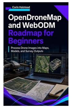
OpenDroneMap and WebODM Roadmap for Beginners: Process Drone Images into Maps, Models, and Survey Outputs

Hundreds of sharp aerial photographs do not automatically become a trustworthy map.
Reliable geospatial results require suitable flight geometry, consistent overlap, controlled camera settings, accurate coordinate references, appropriate processing choices, and evidence that the finished product is fit for its intended use.
OpenDroneMap and WebODM Roadmap for Beginners provides a practical, step-by-step path from a folder of aerial photographs to documented orthophotos, point clouds, elevation surfaces, textured 3D products, measurements, and client-ready geospatial deliverables.
Rather than encouraging readers to select every high-quality option and hope for a better result, this guide teaches a controlled workflow: define the required deliverable, inspect the source data, establish a baseline, change one meaningful setting at a time, validate the result, and preserve enough evidence to reproduce the project later.
Inside, you'll learn how to:
Understand how photogrammetry reconstructs three-dimensional geometry from overlapping photographsChoose the correct product for mapping, terrain analysis, stockpile work, inspection, or 3D visualisationPlan nadir, cross-grid, oblique, perimeter, and terrain-following capture patternsSelect practical ground sampling distance and overlap targetsReduce blur, exposure changes, weak focus, missing coverage, and inconsistent geometryPlan ground control and independent checkpointsInstall and verify a local processing environmentUnderstand Docker containers, volumes, ports, storage, and resource allocationCreate projects and baseline tasks through a browser-based workflowMonitor task states and interpret processing logs without guessingRun reproducible command-line jobs through DockerPreserve exact commands, versions, data revisions, logs, and processing recordsChoose orthophoto, elevation, point-cloud, mesh, texture, and boundary settings deliberatelyUnderstand coordinate reference systems, units, datums, and vertical-height differencesUse ground control points, RTK or PPK camera positions, and independent checkpoints responsiblyEvaluate accuracy without confusing resolution, precision, and visual qualityInspect orthophotos for seams, ghosting, distortion, gaps, and edge defectsExamine point clouds, DSMs, DTMs, and textured geometry for processing problemsLoad accepted results into QGISCreate contours, hillshades, profiles, measurements, and delivery packagesMeasure stockpiles and earthworks with clearly stated assumptionsWork with multispectral, thermal, 3D, and repeat-survey datasetsDiagnose failed reconstruction, weak geometry, resource exhaustion, and coordinate problemsScale processing through additional nodes, split-merge strategies, automation, and controlled presetsBack up project media, database information, commands, settings, and accepted resultsA continuing mapping project connects the chapters. You will inspect its photographs, organise the source material, complete a baseline reconstruction, compare processing strategies, add spatial control, assess accuracy, validate each major output, and assemble a professional delivery package.
The explanations are beginner-friendly, but the working method reflects serious professional practice. Accuracy claims must be supported by evidence. Ground control must not be confused with independent validation. Attractive output must not be treated as proof of correct measurement.
Customer Reviews
ThriftBooks ® and the ThriftBooks ® logo are registered trademarks of Thrift Books Global, LLC
