
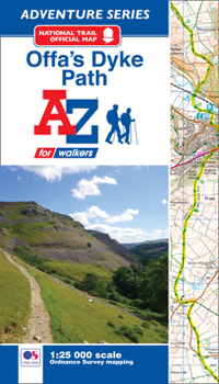
Offa's Dyke Path A-Z Adventure Atlas
No Customer Reviews

The A-Z Adventure Series of maps combines the best of OS and A-Z, creating the perfect companion for walkers, off-road cyclists, horse riders and anyone wishing to explore the great outdoors.Offa's Dyke Path is a National Trail skirting the English/Welsh border. The 177 mile (285km) path is named after, and often follows, the spectacular 8th century Offa's Dyke. The trail links Sedbury Cliffs near Chepstow with the coastal town of Prestatyn, crossing the border over 20 times along the way. The route on the map is clearly highlighted in yellow with mileage markers to gauge distances when planning sections of the walk to enjoy.This official National Trail Map* of Offa's Dyke Path features 52 pages of continuous Ordnance Survey 1:25000 mapping, providing complete coverage of the Offa's Dyke Path. The atlas includes a route planner showing distances between places and the amenities available, featuring:*Information Centres*Hotels/B&Bs*Youth Hostels*Campsites (seasonal opening)*Public Houses*Shops*Restaurants*Cafes (seasonal opening)*Petrol StationsAlso featured is advice on safety and security when walking and a selection of QR codes linked to useful websites, including temporary route updates from the National Trails, regional information, map reading advice and weather reports.Unlike the original OS sheets, this A-Z Adventure Atlas includes a comprehensive index to towns, villages, hamlets and locations, natural features, nature reserves, car parks and youth hostels, making it easy to find the required location quickly. Each index entry has a page reference and a six figure National Grid Reference. With a book size of 240mm x 134mm it is the same size as the standard OS folded map.Other National Trails available within the A-Z Adventure series include: Cotswold Way, Hadrian's Wall Path, North Downs Way, Pembrokeshire Coast Path, Pennine Way, South Downs Way, SW Coast Path, Thames Path and The Ridgeway.*A-Z is the official mapping partner of the National Trails.
Format:Paperback
Language:English
ISBN:1782571663
ISBN13:9781782571667
Release Date:September 2018
Publisher:Geographers' A-Z Map Company Ltd.
Length:72 Pages
Weight:0.28 lbs.
Dimensions:0.2" x 5.3" x 9.4"
Related Subjects
TravelCustomer Reviews
0 rating
Copyright © 2026 Thriftbooks.com Terms of Use
| Privacy Policy | Do Not
Sell/Share My Personal Information | Cookie Policy | Cookie Preferences | Accessibility Statement
ThriftBooks® and the ThriftBooks® logo are registered trademarks of Thrift Books Global, LLC
ThriftBooks® and the ThriftBooks® logo are registered trademarks of Thrift Books Global, LLC
