


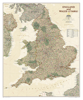
National Geographic England and Wales Wall Map - Executive - Laminated (30 X 36 In)

England and Wales (Cymru) are presented in exceptional detail in National Geographic's Executive style wall map. As attractive as it is functional, this map features an antique color palette, stunning shaded relief, and a subtle background grid pattern that echoes the cartographic precision that underlies all National Geographic maps. This map includes thousands of place names--including Welsh and Manx names--transportation networks, and administrative divisions. National Parks, historical sites, roads, motorways, airports, canals, oil pipelines, and passenger and high-speed railroads are shown. In addition to England and Wales (Cymru), coverage includes portions of Scotland, Northern Ireland, Ireland, and France.
The map is encapsulated in heavy-duty 1.6 mil laminate which makes the paper much more durable and resistant to the swelling and shrinking caused by changes in humidity. Laminated maps can be framed without the need for glass, so the frames can be much lighter and less expensive.
Map Scale = 1:868,420Sheet Size = 30 x 36Customer Reviews
ThriftBooks ® and the ThriftBooks ® logo are registered trademarks of Thrift Books Global, LLC
