
Mount Stuart, Wa No. 209
No Customer Reviews

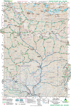
Westside hikers tired of gloomy cloudy skies often flock to the sunny slopes of the Teanaway Country. This map covers the heart of this region known for its agreeable weather, pine scented forests, diverse wildflowers and exceptional hiking trails and scrambling routes. Map 209 displays much of the Middle and North Fork Teanaway Valleys and the trails traversing the slopes above them. This map covers Gallagher Lake, the Esmeralda Basin, spectacular Lake Ingalls, Koppen Mountain, Iron Peak, Earl Peak, Navaho Peak and the Three Brothers. Much of the Ingalls Creek Trail is also shown on the map. And of course 9415-foot Mount Stuart and the core of the famous Enchantment Lakes basin. Reprinted 2021
Format:Map
Language:English
ISBN:168051444X
ISBN13:9781680514445
Release Date:July 2021
Publisher:Green Trails Maps
Length:2 Pages
Related Subjects
TravelCustomer Reviews
0 rating
Copyright © 2026 Thriftbooks.com Terms of Use
| Privacy Policy | Do Not
Sell/Share My Personal Information | Cookie Policy | Cookie Preferences | Accessibility Statement
ThriftBooks® and the ThriftBooks® logo are registered trademarks of Thrift Books Global, LLC
ThriftBooks® and the ThriftBooks® logo are registered trademarks of Thrift Books Global, LLC
