
Moab North

Select Format
Select Condition 
Book Overview
- Waterproof - Tear-Resistant - Topographic Map
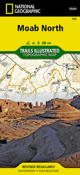
A popular destination for mountain biking, hiking, whitewater rafting, and four-wheeling, Moab offers adventure and recreation in one of the most iconic landscapes in the United States. National Geographic's Trails Illustrated map of Moab North was created in partnership with local land management agencies to provide unmatched detail of the area and useful information to help you get the most from your visit. The print map includes an inset of Monitor & Merrimac Buttes / Sovereign Trail and Moab / Slickrock areas, as well as additional detail of the following three regions: Monitor & Merrimac Buttes / Bartlett Wash / Sovereign Trail; Moab / Slickrock / Porcupine Rim; and Green River and Tenmile Point. Other areas of interest featured on this map include Arches National Park, Professor Valley, Fisher Towers, and Dewey Bridge.
Particular attention is shown to the extensive trail systems in the area. Information on mountain bike and Jeep trails includes their difficulty rating, mileage, and location. A listing of popular hiking-only trails is included, and the western portion of Kokopelli's Trail that traverses the region is highlighted. The clearly marked trails include trail use and mileages between intersections. River mileage on the Colorado and Green rivers is noted as well, for those exploring by boat. Biker and desert safety tips are offered and recreation features such as campgrounds, trailheads, river access, boat launches, interpretive trails, and scenic overlooks are noted. The map base includes contour lines and elevations for summits and passes.
Every Trails Illustrated map is printed on Backcountry Tough waterproof, tear-resistant paper. A full UTM grid is printed on the map to aid with GPS navigation.
Other features found on this map include: Arches National Park, Dolores River, Manti-La Sal National Forest, Salt Valley.
Map Scale = 1:70,000 & 1:35,000Sheet Size = 37.75 x 25.5Folded Size = 4.25 x 9.25Related Subjects
TravelCustomer Reviews
ThriftBooks ® and the ThriftBooks ® logo are registered trademarks of Thrift Books Global, LLC
