
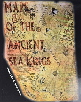
Maps of the Ancient Sea Kings: Evidence of Advanced Civilization in the Ice Age

Select Format
Select Condition 
Book Overview
Charles Hapgood's classic 1966 book on ancient maps is back in print after 20 years. Hapgood produces concrete evidence of an advanced worldwide civilization existing many thousands of years before ancient Egypt. He has found the evidence in many beautiful maps long known to scholars, the Piri Reis Map that shows Antarctica, the Hadji Ahmed map, the Oronteus Finaeus and other amazing maps. Hapgood concluded that these maps were made from more ancient maps from the various ancient archives around the world, now lost. Hapgood also concluded that the ancient mapmakers were in some ways much more advanced scientifically than Europe in the 16th century, or than the ancient civilizations of Greece, Egypt, and Babylonian. Not only were these unknown people more advanced in mapmaking than any people prior to the 18th century, it appears they mapped all the continents. The Americas were mapped thousands of years before Columbus. Antarctica was mapped when its coasts were free of ice. There is evidence that these people must have lived when the ice age had not yet ended in the Northern Hemisphere and when Alaska was still connected with Siberia by the Pleistocene, ice age "land bridge."
Format:Paperback
Language:English
ISBN:0932813429
ISBN13:9780932813428
Release Date:January 2014
Publisher:Adventures Unlimited Press
Length:316 Pages
Weight:1.84 lbs.
Dimensions:0.8" x 8.1" x 10.0"
Customer Reviews
1 rating
Can you say spherical geometry?
Published by bernie4444 , 11 days ago
This book is worth keeping for the pictures alone. At least my copies have color and do look like coffee table books. I do not want to argue validity. That is up to the author. Nevertheless, there is no other book that really covers the Piri Reis map. It seems to have disappeared from the Internet. I have been able to find a few other references now and then, like other people mentioning the fact that Columbus did have a map case of sorts.
The story goes that the crew was not afraid of falling off the end of the earth, but that Columbus was a poor navigator. All this flat-earth stuff is much later than Columbus was. The map he had was a composite, and he missed his landing point. However, no one else is as enthusiastic as Charles H. Hapgood is. As far as who got to the west first, it seems that anyone falling in the water would turn up here. So, what is the big deal? The deal is that maps such as these are the tangible proof that others have done so.
As far as the secondary proofs of building styles, 101 architecture class will tell you that with similar building materials, you get similar structures. The one piece of information that is hard to dismiss is the Antarctic coastline accuracy.
People may agree or disagree with the conclusions drawn, but the maximum star rating is for an excellent presentation that makes people think.
Next, check out “The Piri Reis Map of 1513” by Gregory C. McIntosh, ISBN-13: 978-0820321578
Copyright © 2025 Thriftbooks.com
Terms of Use | Privacy Policy | Do Not Sell/Share My Personal Information | Cookie Policy | Cookie Preferences | Accessibility Statement
ThriftBooks ® and the ThriftBooks ® logo are registered trademarks of Thrift Books Global, LLC
ThriftBooks ® and the ThriftBooks ® logo are registered trademarks of Thrift Books Global, LLC
