
Lonely Planet Rome City Map: Durable, Waterproof, Easy-Fold Planning Map with Attractions & Walking Tours
No Customer Reviews

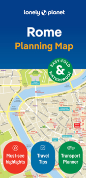
Experience your dream trip with Lonely Planet's Rome City Map, the ultimate travel tool to help you plan and navigate your way around amazing local sights, landmarks and attractions. Toss a coin into Trevi Fountain, explore the world-famous Vatican Museums, see the Colosseum up close, and decide where you want to go next and what you want to see in each of the city's exciting neighbourhoods. Inside Lonely Planet's Rome City Map: Full colour map in a durable easy-fold formatSheet size: 24.8" (630mm) wide x 19.5" (494mm) high, folded size: 3.74" (95mm) wide x 7.76" (197mm) highWaterproof and packaged in a handy slipcaseAlphanumeric grid to find points of interest easilyPublic transport and tickets explained to help you get aroundTop picks of must-see highlights including the Pantheon, the Spanish Steps, and St Peter's BasilicaEssential travel tips and nuts and bolts information including how to speak like a local, and travelling to and from the airportBeautiful photography and bonus zoomed-in map ofRome's Metro linesCovers: Borgo, Campitelli, Campo Marzio, Castro Pretorio, Colonna, Esquilino, Gianicolo, Monti, Parione, Pigna, Ponte, Prati, Regola, Salario, Sallustiano, San Giovanni, Sant'Angelo, Sant'Eustachio, Trastevere, Trevi, Tridente, Vatican City, Villa Borghese
Get ready for your next adventure with Lonely Planet's Rome City Map, the ultimate navigation tool to help you explore Rome's well-known attractions and best-kept secrets.
Get ready for your next adventure with Lonely Planet's Rome City Map, the ultimate navigation tool to help you explore Rome's well-known attractions and best-kept secrets.
Format:Loose Leaf
Language:English
ISBN:1787016366
ISBN13:9781787016361
Release Date:February 2024
Publisher:Lonely Planet
Length:2 Pages
Weight:0.07 lbs.
Dimensions:0.1" x 3.9" x 7.8"
Recommended
Format: Loose Leaf
Condition: New
$8.41
Save $1.58!
List Price $9.99
Almost Gone, Only 2 Left!
Ships within 24 hours
Not eligible for Free Shipping 
Save to List
Customer Reviews
0 rating
Copyright © 2026 Thriftbooks.com
Terms of Use | Privacy Policy | Do Not Sell/Share My Personal Information | Cookie Policy | Cookie Preferences | Accessibility Statement
ThriftBooks ® and the ThriftBooks ® logo are registered trademarks of Thrift Books Global, LLC
ThriftBooks ® and the ThriftBooks ® logo are registered trademarks of Thrift Books Global, LLC
