
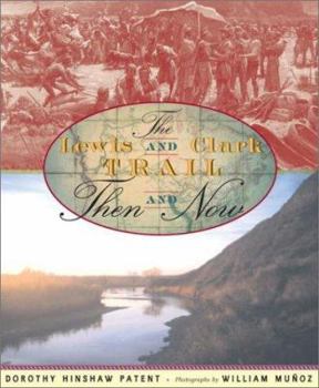
Lewis and Clark Trail, The: Then and Now

Select Format
Select Condition 
Book Overview
When the Lewis and Clark expedition departed on its voyage of exploration in May of 1804, the region of North America west of the Mississippi River was a blank spot on the map. Lewis and Clark were to fill it in with rivers and mountains, Indian tribes, and animals new to European Americans. Today the West is a completely different place from what it was two hundred years ago. Every inch has been mapped, and much of its land has been covered by farms, ranches, cities, and towns. Award-winning author of more than a hundred nonfiction books for children, Dorothy Hinshaw Patent and photographer William Mu?oz capture the contrast between the American West then and now in this informative volume, aided by old prints, photographs, and paintings.
Format:Hardcover
Language:English
ISBN:0525469125
ISBN13:9780525469124
Release Date:November 2002
Publisher:Dutton Juvenile
Length:64 Pages
Weight:1.30 lbs.
Dimensions:11.4" x 0.5" x 9.4"
Age Range:8 to 12 years
Grade Range:Grades 3 to 7
Related Subjects
Biographies Children's Children's Books Exploration & Discovery General Historical History Travel WestCustomer Reviews
1 rating
A solid introduction to the Lewis & Clark Expedition
Published by Thriftbooks.com User , 22 years ago
The story of the Lewis and Clark expedition is the one great exploration of the American continent that was actually undertaken by Americans rather than by Europeans visiting the New World. "The Lewis and Clark Trail Then and Now," with text by Dorothy Hinshaw Patent and Photographs by William Munoz, compares the way things have changed along the route almost two hundred years later. When Lewis and Clark left St. Louis in May of 1804 the United States was a land without telephones, railroads, cars, electrical equipment or dozens of other modern conveniences we take for granted. The region of North American between the Mississippi River and the Pacific Ocean was fill of rivers and mountains, native tribes and indigenous animals, all waiting to be "discovered." Today, this entire region has been mapped, and a lot of that uninhabited land is now covered by farms and ranches, towns and cities. Even the mighty Missouri and Columbia Rivers that Lewis and Clark followed have been damned. Still, there are wilderness areas, such as the Rocky Mountains, where what you would see today has changed little from the time Lewis and Clark first trekked through their landscapes.However, overall the emphasis in this book is more on the "then," even though most of the pictures are of the "now." There is a reproduction of an 1802 map showing the great area of the unexplored American West and some early 19th-century paintings, but the photographs are of contemporary vistas and shots of some of the equipment taken on the expedition. The book does not make an attempt to match up old paintings with new photographs, but rather tries to combine them to give a sense of the places visited and the peoples met along the way. Ultimately, the book fills in the spaces between that unfinished map at the start of the book and the completed map made by Clark that appears at the end. Each chapter is essentially a two-page spread on chronologically arranged topics from Members of the Expedition and Life on the River to Finding the Shoshone and Descending the Might Columbia. The net effect is a concise look at the history making expedition and how it fulfilled President Thomas Jefferson's mandate. Young students assigned to research the topic or simply interested in this part of American history will find "The Lewis and Clark Trail: Now and Then" provides a solid look at the subject.
Copyright © 2026 Thriftbooks.com Terms of Use
| Privacy Policy | Do Not
Sell/Share My Personal Information | Cookie Policy | Cookie Preferences | Accessibility Statement
ThriftBooks® and the ThriftBooks® logo are registered trademarks of Thrift Books Global, LLC
ThriftBooks® and the ThriftBooks® logo are registered trademarks of Thrift Books Global, LLC
