
Lake Mead National Recreation Area Map

- Waterproof - Tear-Resistant - Topographic Map
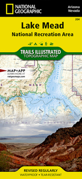
Straddling the border of Arizona and Nevada, Lake Mead National Recreation Area encompasses 1.5 million acres of three of America's four desert ecosystems: the Mojave, the Great Basin, and the Sonoran. National Geographic's Trails Illustrated map of Lake Mead delivers unmatched detail and valuable information to assist you in your exploration of this land of contrasts. Expertly researched and created in partnership with local land management agencies, this map features key points of interest including Valley of Fire State Park, Hoover Dam, Mount Wilson Wilderness, Muddy Mountain Wilderness, River Mountains Loop National Recreation Trail, and a portion of Grand Canyon National Park. Katherine Landing, Cottonwood Cove, Willow Beach, Temple Bar, Callville Bay, and Echo Bay are highlighted, along with the facilities at each.
This map features detailed topography with shaded relief, elevations, and clearly defined, color-coded boundaries for parks, public lands, wilderness areas, and Indian reservations. Helpful content about boating, hunting, fishing, swimming, camping, hiking, and more, as well as safety tips is included. The Gold Butte and Bitter Springs backcountry byways are noted for those wishing to take in the scenery by car. Recreation features are clearly marked, including campgrounds, trailheads, interpretive trails, boat launches, marinas, boat tours, and scenic overlooks.
Every Trails Illustrated map is printed on Backcountry Tough waterproof, tear-resistant paper. A full UTM grid is printed on the map to aid with GPS navigation.
Other features found on this map include: Black Mountains, Boulder City, Bullhead City, Cerbat Mountains, Detrital Valley, Eldorado Mountains, Fortification Hill, Grand Canyon, Grand Canyon National Park, Henderson, Hidden Canyon, Hoover Dam, Lake Mead, Lake Mead National Recreation Area, Lake Mohave, Lower Granite Gorge, Mohave Valley, Mount Perkins, Mount Tipton, Muddy Mountains, Newberry Mountains, Overton Arm, Sanup Plateau, Virgin Mountains, Virgin River, White Hills.
Map Scale = 1:125,000Sheet Size = 37.75 x 25.5Folded Size = 4.25 x 9.25Recommended
Format: Loose Leaf
Condition: New

Related Subjects
TravelCustomer Reviews
ThriftBooks ® and the ThriftBooks ® logo are registered trademarks of Thrift Books Global, LLC
