
Kanab Utah Topo Map Index: 7.5' Topographic Quadrangle Atlas and Gazetteer - Small Print

One of a series of 46 atlases covering the entire state of Utah, the Kanab Utah Topo Map Index contains 32 historical USGS topographic 7.5' quadrangle maps of the Kanab, Utah, area, named after the 30'x60' USGS topo map of the area carrying the same name. This area is a box sandwiched between 37 N and 37.5 N latitude, and between 113 W and 112 W longitude.
Printed at reduced size (book format is letter-size: 8.5x11 inches) in small print. The original maps were produced by the U.S. Geological Survey (USGS).
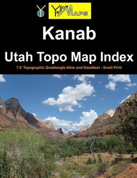
The Kanab atlas serves as an index to finding and previewing 7.5 minute maps, along with QR codes and website URLs for downloading or ordering full-size print copies of said 7.5' maps at 1:24,000 scale. This atlas also includes a gazetteer of geographic features, and is illustrated by publisher YellowMaps with landscape photographs of the local area.
List of 7.5 minute quad maps included in this book: Cogswell PointStraight CanyonStrawberry PointLong Valley JunctionAltonPodunk CreekRainbow PointBull Valley GorgeTemple Of SinawavaClear Creek MountainOrdervilleGlendaleBald KnollSkutumpah CreekDeer Spring PointDeer Range PointSpringdale EastThe BarracksMount CarmelWhite TowerCutler PointPine PointNephi PointEightmile PassHildaleElephant ButteYellowjacket CanyonKanabThompson PointJohnson LakesPetrified HollowPine Hollow CanyonRelated Subjects
ReferenceCustomer Reviews
ThriftBooks® and the ThriftBooks® logo are registered trademarks of Thrift Books Global, LLC
