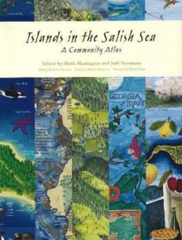
Islands in the Salish Sea: A Community Atlas
Gorgeous, fascinating and unconventional, the maps in this collection show aspects of the Gulf Islands, the "Islands in the Salish Sea," that are most beloved by the residents, from heritage orchards,... This description may be from another edition of this product.
Format:Paperback
Language:English
ISBN:189489832X
ISBN13:9781894898324
Release Date:November 2005
Publisher:Touchwood Editions
Length:160 Pages
Weight:1.50 lbs.
Customer Reviews
1 rating
This Book Is Sure To Inspire You To Protect & Sustain Your Own Home Place
Published by Thriftbooks.com User , 16 years ago
As geographer Briony Penn points out in her inspired and compassionate foreword to Islands in the Salish Sea, "The urge to map comes from the same base as the urge to sing, dance or write... If someone has taken the time and effort to record it, then it has value. People become aware of and sensitized to these values, and they can then become advocates for them." From a childlike state of curiosity and imagination, over 3000 people on seventeen of the islands in British Columbia's Strait of Georgia became involved in a five-year project of community mapping that, as Penn describes it, became "a reflection of all the love and positive power in a community". It does my heart good just to know of such a project. The name "Salish Sea" is a term used in recognition of the Salish-speaking people who live in and around the Strait of Georgia down to Puget Sound in the state of Washington. As oil, fish or marine mammals know no boundaries, Canadian/American biologist Bert Webber began to use the name "Salish Sea" in the 1970s. Judi Stevenson and Sheila Harrington, who both live on Salt Spring Island in British Columbia, were the overall coordinators of the Islands in the Salish Sea Community Mapping Project under the sponsorship of the Land Trust Alliance of British Columbia with support from the West Coast Islands Conservancy. (Four islands are actually outside the Trust's present boundaries but the purpose was to link the bioregion as a whole.) The first workshop the coordinators presented on Salt Spring Island in January 2000 enticed other island representatives into the project. By early spring almost every island had a local coordinator and a host organization. The maps that resulted from countless hours of the sharing of local knowledge and artistry came to be maps that didn't answer the question, how do we get there from here but rather, what do we love about our home places, including all the creatures who dwell here, and how will we save them? ("Home place" is a term attributed to one of Canada's first ecologists, Stan Rowe, and describes the heart of this community mapping project.) Three major concerns were to be in the minds of the map makers as they set out to describe their home places: special or endangered features of the natural world; First Nations' interests and past occupancy; and some reference to more recent human settlement and activity. Innovative approaches were used to create maps including video, felted images, a photo collage. Not all maps were used in the book but the essence of each was included in the final maps created by professional artists. Included in the book is a cedar panel carved and painted by Native artisan Herb Rice who writes of the myths of Kuper Island. Leanne Hodges used recycled pulped paper to make a three-dimensional, bas-relief of Quadra Island. On Galiano Island, one of the maps was rendered in beadwork. Caffyn Kelley of Salt Spring Island made a map of silks, "Cloak for a Watershed Guardia


