


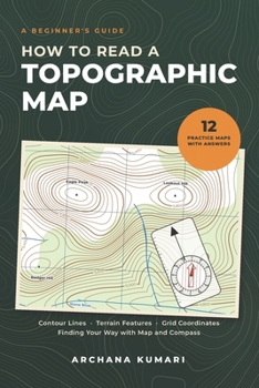
How to Read a Topographic Map: A Beginner's Guide to Contour Lines, Terrain Features, Grid Coordinates, and Finding Your Way with Map and Compass
No Customer Reviews

Those thin brown lines are telling you everything. Learn to read them. A topographic map shows far more than where things are. It shows the shape of the land itself: how high, how steep, where the water runs and what lies between you and the place you want to reach. To most people it looks like a tangle. This book untangles it, from zero, in small steps, with a picture for almost every idea. What you will learnHow contour lines work, and how to see hills, valleys, ridges, saddles, spurs, draws and cliffs in themHow to read the height of any point and judge the steepness of any slopeThe rule of Vs: which way a stream flows and how to tell a valley from a ridgeHow to draw a profile and check whether you can see one point from anotherScale, bar scales and measuring real trail distanceGrid references made simple: right, then upTrue north, grid north, magnetic north and declination without the confusionHow to take a bearing from the map, follow it on the ground, and estimate your positionRoute planning with handrails, attack points and catching features, plus realistic time estimatesBuilt for practice More than 50 maps and diagrams illustrate the lessons. Twelve practice maps include 66 questions and worked answers, with guidance on reasonable estimates and measurement tolerances. A quick reference section and a glossary are included. For US and international readers The teaching examples combine US-style maps in feet and miles with five practice maps that use metric contour intervals. A chapter introduces common national map series and explains what to check on an unfamiliar map. Who it is for Hikers, backpackers, hunters, scouts, trail runners, search and rescue volunteers, cadets preparing for land navigation, geography and earth science students, and anyone who wants to stop following a blue dot and start understanding the ground. Every map in this book shows invented terrain and is for learning only.
Format:Paperback
Language:English
ISBN:B0HKJ4P553
ISBN13:9798176018981
Release Date:September 2026
Publisher:Independently published
Length:130 Pages
Weight:0.41 lbs.
Dimensions:9.0" x 0.3" x 6.0"
Customer Reviews
0 rating
Copyright © 2026 Thriftbooks.com
Terms of Use | Privacy Policy | Do Not Sell/Share My Personal Information | Cookie Notice | Cookie Preferences | Accessibility Statement
ThriftBooks ® and the ThriftBooks ® logo are registered trademarks of Thrift Books Global, LLC
ThriftBooks ® and the ThriftBooks ® logo are registered trademarks of Thrift Books Global, LLC
