

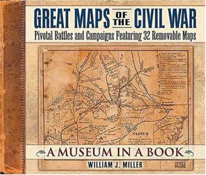
Great Maps of the Civil War: Pivotal Battles and Campaigns Featuring 32 Removable Maps

Select Format
Select Condition 
Book Overview
When Union General George McClellan marched toward the Confederate capital of Richmond in 1862, he encountered the Warwick River "where it wasn't supposed to be." McClellan was following a map created... This description may be from another edition of this product.
Format:Hardcover
Language:English
ISBN:1558539999
ISBN13:9781558539990
Release Date:January 2004
Publisher:Thomas Nelson
Length:76 Pages
Weight:0.05 lbs.
Dimensions:1.0" x 12.4" x 10.2"
Customer Reviews
4 ratings
A beautiful book. Recommended for map lovers and hard-core Civil War buffs (a history teacher's revi
Published by Thriftbooks.com User , 16 years ago
Thomas Nelson's Rutledge Hill Press publishing division has created a lovely book that tells a simple narrative of the Civil War focusing on the importance of maps in the war and the men who made them. The cover of the book is designed to look like a leather bound canvas portfolio, much like a mapmaker's sketchbook of the era. The text of the book is beautifully printed on high quality paper. I appreciated the fact that the publishers included lots of pictures of everday soldiers - not just the same old posed shots of the generals and politicians. There are 32 removable maps included as well. The removable maps are stored in between the pages. The publisher has printed on only one side of the thick paper pages and then glued the blank sides together on the edges to make an envelope of sorts between the pages. The maps are securely stored so there is no chance of accidentally losing a map. I would not recommend this book as an introduction to the topic of the Civil War since it does precious little to introduce the issues that caused the war or Reconstruction. However, it is an attractive volume that would be welcome in the collection of any Civil War buff.
It's excellent, but better exists
Published by Thriftbooks.com User , 18 years ago
This text by Miller is excellent, but "Maps and Mapmakers of the Civil War" by Earl B. McElfresh is superior. I suggest reading McElfresh's book first and this one second.
Maps really mattered in the American Civil War
Published by Thriftbooks.com User , 18 years ago
As the Forward to this beautifully rendered large format book states, "The war was first waged on paper. Before troops engaged in battle, both sides plotted strategy and tactics on the maps of the day. Knowing the field, understanding the terrain, recognizing the route of assault--and the line of retreat--could determine triumph or defeat." Perhaps more so than in wars since, the American Civil War was fought primarily by massing large troop formations against each other. As a consequence, moving those men and their equipment using the most efficient and advantageous route became paramount. More often than not, occupation of key terrain meant victory, and therefore, arriving at the right spot, first, and with the most men was a strategic necessity in every encounter. Typical in books of this nature, what you experience is a detailed depiction of the array of military forces produced on a map after the battle was fought. What the author (William J. Miller) states as one of his primary objective in this book, was to provide the reader with a set of maps (in this case there are actually 32 removable maps) that were used by the participants in this war or would have commonly been available to them at the time. And to present with these maps, the same depiction of the terrain as seen by the commanders as they planned their operations. Miller's stated intent was to help the reader understand why a particular battle was fought the way that it was, rather than just how it was fought, as an after-the-fact. Having said that, Miller does include a number of very detailed and artistically accurate post battlefield maps, like the famous and extremely collectible Bachelder Bird's-eye Panoramic of Gettysburg. He also devotes a great deal space in the book to describing the technology of map making and reproduction at that time in history, and fills his book with interesting stories about the consequence of fighting blind or with gross geographically errors. All in all this is a wonderful book. It is probably not the type of book to be read in one sitting or even sequentially, rather one to be kept as a reference and authoritative resource for reading and rereading. It simply is a beautiful book, truly unique in its field, and more than worth the price that is sells for new. It is a collectible filled with removable copies of collectible material. My highest recommendation for the Civil War enthusiast!
Maps Transport Us
Published by Thriftbooks.com User , 19 years ago
As schoolchildren we all gazed in wonder at the crude, fanciful and often highly distorted maps of other ages. The nuances and truth of a map are alas diminished by reproduction. Take note that all great libraries have map rooms, with elegant thin-drawered cabinets that hold the worldviews of the ages. And that is the genius of this volume. By providing the maps so they can be pulled out, laid on a table and pondered, traced, turned and measured, it is easy to be transported to a dimly lit tent on a soft Southern night. In the age of Mapquest and GPS handhelds, nothing is more real than a contemporaneous map. It is a record, a voice, and an accoutrement, as vital to understanding as any diary, written record or photograph.
Copyright © 2023 Thriftbooks.com Terms of Use | Privacy Policy | Do Not Sell/Share My Personal Information | Cookie Policy | Cookie Preferences | Accessibility Statement
ThriftBooks® and the ThriftBooks® logo are registered trademarks of Thrift Books Global, LLC
ThriftBooks® and the ThriftBooks® logo are registered trademarks of Thrift Books Global, LLC
