


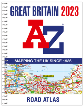
Great Britain A-Z Road Atlas 2023 (A4 Spiral)
No Customer Reviews

Find your way around Great Britain with this fully revised and updated road atlas.
An A4-size, spiral bound, full colour road atlas, now fully revised and updated. Clear detailed road mapping at a mainland map scale of 3.5 miles to 1 inch, 2.22 km to 1 cm.
This essential road atlas includes the following:
11 pages of main route mapping covering Greater London, Birmingham and ManchesterRoute planning mapsMileage chart with average journey timesInformation on motorway junctions with limited interchanges80 city and town centre street plans16 port and airport plansChannel Tunnel terminus mapsIndex to cities, towns, villages, hamlets, major destinations and selected places of interest with postcodes for satnav useMap key also in French and GermanInstantly recognisable and easy to use, A-Z road mapping includes the following features:
clear standard road classification colours for easy identificationfull motorway junction detailunder construction and proposed roadsprimary route destinationsservice areasselected truckstop locationsnational and county boundaries and a wide range of tourist and ancillary information, including Blue Flag BeachesA portable sized publication with a spiral binding; a popular choice for those wanting superb map clarity. Ideal choice to fit in any vehicle glovebox.
Format:Spiral-bound
Language:English
ISBN:0008528721
ISBN13:9780008528720
Release Date:October 2022
Publisher:Geographers' A-Z Map Company Ltd.
Length:280 Pages
Weight:1.63 lbs.
Dimensions:0.8" x 8.3" x 10.6"
Related Subjects
TravelCustomer Reviews
0 rating
Copyright © 2026 Thriftbooks.com
Terms of Use | Privacy Policy | Do Not Sell/Share My Personal Information | Cookie Policy | Cookie Preferences | Accessibility Statement
ThriftBooks ® and the ThriftBooks ® logo are registered trademarks of Thrift Books Global, LLC
ThriftBooks ® and the ThriftBooks ® logo are registered trademarks of Thrift Books Global, LLC
