
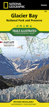
Glacier Bay National Park and Preserve Map

- Waterproof - Tear-Resistant - Topographic Map
National Geographic's Trails Illustrated map of Glacier Bay National Park and Preserve in Alaska's panhandle is perfect for hiking, camping, boating, paddling, and wildlife viewing in this scenic, rugged frontier. Created in partnership with local land management agencies, this expertly researched map delivers unmatched detail and helpful information for experienced outdoor enthusiasts and casual visitors alike. Some of the key areas of interest covered include Glacier Bay Wilderness, portions of Tongass National Forest, Chicagof Island, Endicott River Wilderness, Chilkat State Park, Chilkat Islands, Sullivan Island State Marine Park, Pleasant Island, Lemesurier Island, Inian Islands, and Tatshenshini Alsek Park. Waterways include the Gulf of Alaska; Glacier, Tituya, Berners, Tidal, Scidmore, and Taylor bays; Cross Sound; Icy Strait; Lynn Canal; North Passage; and Geikie, Muir, Tarr, Chilkoot, Chilkat, Wachusett, Queen, and Rendu inlets. The print version of this map contains detailed insets of Tarr and Johns Hopkins inlets, Gustavus, and Lamplugh Glacier.
Transportation in Glacier Bay's wilderness can be challenging, but you'll find the information you need on this map with an accurate road network, ferries, boat ramps, harbors and anchorages, seaplane bases, seaplane anchorages, airports, and landing strips. In addition to contour lines, shaded relief, and summit elevations, this map highlights the many waterways with bathymetry, depths, and navigational aids. A handy distance chart will help you plan your outings. Many recreation features and facilities are noted as well, including hiking trails, campgrounds, picnic areas, rental cabins, lodging, boat fueling stations, ranger stations, and scenic byways.
Every Trails Illustrated map is printed on Backcountry Tough waterproof, tear-resistant paper. A full UTM grid is printed on the map to aid with GPS navigation.
Other features found on this map include: Alsek Glacier, Alsek River, Brady Glacier, Cape Fairweather, Cape Spencer, Carroll Glacier, Casement Glacier, Chilkat Lake, Chilkat Range, Chilkat River, Cross Sound, Endicott River Wilderness, Fairweather Range, Glacier Bay, Glacier Bay National Park, Glacier Bay National Preserve, Grand Plateau Glacier, Icy Point, Icy Strait, Johns Hopkins Inlet, La Chaussee Spit, Muir Glacier, Muir Inlet, Novatak Glacier, Palma Bay, Plateau Glacier, Pleasant Island, Pleasant/Lemusurier/Inian Islands Wilderness, Tarr Inlet, Tongass National Forest.
Map Scale = 1:100,000 & 1:240,000Sheet Size = 37.75 x 25.5Folded Size = 4.25 x 9.25Recommended
Format: Loose Leaf
Condition: New

Related Subjects
TravelCustomer Reviews
ThriftBooks® and the ThriftBooks® logo are registered trademarks of Thrift Books Global, LLC
