

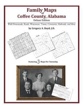
Family Maps of Coffee County, Alabama, Deluxe Edition
No Customer Reviews

Select Format
Select Condition 
Book Overview
Locating original landowners in maps has never been an easy task-until now. This volume in the Family Maps series contains newly created maps of original landowners (patent maps) in what is now Coffee County, Alabama, gleaned from the indexes of the U.S. Bureau of Land Management. But it offers much more than that. For each township in the county, there are two additional maps accompanying the patent map: a road map and a map showing waterways, railroads,...
Format:Paperback
Language:English
ISBN:1420315528
ISBN13:9781420315523
Release Date:May 2010
Publisher:Arphax Publishing Co.
Length:326 Pages
Weight:1.67 lbs.
Dimensions:0.7" x 8.5" x 11.0"
Related Subjects
ReferenceCustomer Reviews
0 rating
Copyright © 2023 Thriftbooks.com Terms of Use | Privacy Policy | Do Not Sell/Share My Personal Information | Cookie Policy | Cookie Preferences | Accessibility Statement
ThriftBooks® and the ThriftBooks® logo are registered trademarks of Thrift Books Global, LLC
ThriftBooks® and the ThriftBooks® logo are registered trademarks of Thrift Books Global, LLC
