
Everglades National Park Map

- Waterproof - Tear-Resistant - Topographic Map
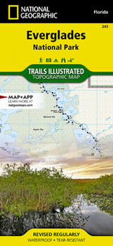
Visited by more than 1 million people a year, Everglades National Park has one of the world's most diverse ecosystems and is an international treasure. Outdoor enthusiasts exploring this unique and fragile environment will marvel at National Geographic's Trails Illustrated map of the park. Created in cooperation with the National Park Service and others, this expertly researched map covers not only the park, but also parts of neighboring John Pennekamp Coral Reef State Park, Big Cypress National Preserve and Cape Romano Ten Thousand Islands Aquatic Preserve, as well as Everglades City and Key Largo. Inset maps provide extensive detail of Flamingo, Whitewater Bay, Pineland Trails of the Long Pine Key area and Nine Mile Pond.
Mapped canoes trails will guide you through the area's bays, lakes and other waterways. The 99-mile Wilderness Waterway is mapped in its entirety along with its NPS markers, backcountry campsites and chickees. The Whitewater Bay area additionally shows Coast Guard markers, sounding depths and sub-surface conditions. Those exploring on foot can enjoy mapped hiking trails, many displaying mileage markers. To aid in your navigation, the map displays areas of mangroves, hardwood hammocks and wooded cover, marshes, sawgrass prairies, wildlife protection areas, selected waypoints and clear color-coded national park, national preserve and state park boundaries. Additional recreation features and facilities pinpointed include marinas, boat launch areas, bike trails, interpretive trails, showers and restrooms.
Every Trails Illustrated map is printed on "Backcountry Tough" waterproof, tear-resistant paper. A full UTM grid is printed on the map to aid with GPS navigation.
Other features found on this map include: Barnes Sound, Big Cypress, Cape Sable, Everglades, Florida Bay, Ponce de Le n Bay, Ten Thousand Islands, Whitewater Bay.
Map Scale = 1:100,000Sheet Size = 25.5" x 37.75"Folded Size = 4.25" x 9.25"Recommended
Format: Loose Leaf
Condition: New

Related Subjects
TravelCustomer Reviews
ThriftBooks ® and the ThriftBooks ® logo are registered trademarks of Thrift Books Global, LLC
