
Ecuador Laminated Map
No Customer Reviews

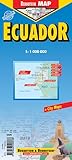
An English language laminated road and travel map in color of Ecuador with shaded relief to show hills and mountains. Scale 1:1,000,000. The map differentiates 5 different types of roads and paths and shows airports, national parks, nature reserves, beaches, monuments churches, bird sanctuaries, waterfalls, archaeological sites, camping sites, caves, lighthouses, golf courses, markets, and famous buildings. Indexed with cities, points of interest and parks. Inset map of the Galapagos Islands shows airports, scuba and snorkeling locations, lighthouses, shipwrecks, and beaches. Scale 1:1,300,000. Inset of greater Quito area shows neighborhoods, hospitals, churches, and museums. Scale 1:100,000. Inset of central Quito shows museums, monuments, tourist information centers, theaters, churches, hospitals, universities and secondary schools, and parks. Scale 1:20,000. Inset of Guayaquil scale 1:18,000. Inset of Cuenca scale 1:17,000. Inset of Ingapirca scale 1:800. Inset maps are indexed with places, neighborhoods, streets, points of interest, public buildings, embassies, hotels, markets, and parks.
Format:Map
Language:English
ISBN:3866090536
ISBN13:9783866090538
Release Date:June 2005
Publisher:Berndtson & Berndtson / Borch
Length:2 Pages
Weight:0.18 lbs.
Dimensions:0.5" x 4.2" x 9.7"
Customer Reviews
0 rating
Copyright © 2026 Thriftbooks.com Terms of Use
| Privacy Policy | Do Not
Sell/Share My Personal Information | Cookie Policy | Cookie Preferences | Accessibility Statement
ThriftBooks® and the ThriftBooks® logo are registered trademarks of Thrift Books Global, LLC
ThriftBooks® and the ThriftBooks® logo are registered trademarks of Thrift Books Global, LLC
