
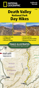
Death Valley National Park Day Hikes Map

- Waterproof - Tear-Resistant - Topographic Map
The largest national park in the contiguous United States, Death Valley protects more than 5,000 square miles of the Mojave Desert--93% of which is federally designated wilderness--encompassing land between the Amargosa Range to the east, the Panamint Range to the west, and beyond.
Death Valley is one of the world's hottest, driest, and lowest places. Badwater Basin salt flats are among the largest protected salt flats in the world and include the lowest elevation on the North American continent at 282 feet below sea level. A land of extremes, Death Valley National Park is more than its summer heat records, featuring spring-fed desert oases, wind-blown rolling sand dunes, snow-frosted winter peaks, and stunning wildflower blooms after rare spring rains.
The Death Valley National Park Day Hikes Topographic Map Guide contains detailed maps for 18 of Death Valley's finest day hikes, including well-known hikes and a few off-the-beaten-path trails. They range from easy strolls to strenuous climbs, selected to provide a sampling of all the park has to offer. Together, they cover almost 100 miles of adventures. One-third of the selected hikes are less than 6 miles long, two-thirds are less than 8 miles, and two hikes are over 10 miles long.
Each of the 18 maps include directions to the trailhead, the total distance to complete the hike, and an estimate of the degree of difficulty. Also provided are elevations of key points on the trail, an elevation profile for the hike, and a calculation of the hike's total elevation gain. Concise trail descriptions will help you find the hikes that best suit your interests, conditioning, and available time.
Every Trails Illustrated map is printed on "Backcountry Tough" waterproof, tear-resistant paper. A full UTM grid is printed on the map to aid with GPS navigation. Every map purchase helps support the National Geographic Society, an impact driven, nonprofit organization with global reach that uses the power of science, exploration, education, and storytelling to illuminate and protect the wonder of our world.Map Scale = 1:31,680Folded Size = 4.25" x 9.38"
Recommended
Format: Misc.
Condition: New

Related Subjects
TravelCustomer Reviews
ThriftBooks ® and the ThriftBooks ® logo are registered trademarks of Thrift Books Global, LLC
