
All Formats & Editions
1 - 1 of 1 results found
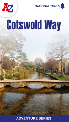
Cotswold Way National Trail Official Map
By A–Z maps
Edition Description
The Cotswold Way is a 102 mile (164 km) National Trail running along the Cotswold Hills. Starting in the historic City of Bath and finishing in Chipping Campden, the clearly marked route passes through numerous places of interest and an abundance of wildlife. This official National...
Edition Details
Format:Paperback
Language:English
ISBN:0008660611
Format: Paperback
Temporarily Unavailable
0 people are interested in this title.
We receive fewer than 1 copy every 6 months.
Copyright © 2026 Thriftbooks.com Terms of Use
| Privacy Policy | Do Not
Sell/Share My Personal Information | Cookie Policy | Cookie Preferences | Accessibility Statement
ThriftBooks® and the ThriftBooks® logo are registered trademarks of Thrift Books Global, LLC
ThriftBooks® and the ThriftBooks® logo are registered trademarks of Thrift Books Global, LLC
