
Collins Handy Street Map London
No Customer Reviews

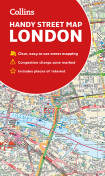
An essential companion whether you are travelling around London by car, public transport or on foot. Clear and easy-to-read map of central London and surrounding area. Contains detailed mapping, presented in a handy compact format. This attractive map, ideal for both tourists and residents, and fully updated, has an extensive area of coverage and displays a wealth of detail. This map includes: * New for this edition: Electric car recharging sites * Fully classified roads * Congestion charging zone & T-charge (Ultra Low Emission Zone from April 2019) * Postal districts and boundaries clearly depicted * Full indexes to street names (on back of map), place names and places of interest * Fully updated London underground map conveniently located on the back cover Covers this area: Extends from Hampstead in the north to Clapham in the south and from Hammersmith in the west to Greenwich in the east. Scale: 1:17,500 (3.6 inches to 1 mile)
Format:Loose Leaf
Language:English
ISBN:0008320586
ISBN13:9780008320584
Release Date:September 2019
Publisher:Collins
Length:1 Pages
Weight:0.20 lbs.
Dimensions:0.4" x 4.3" x 7.4"
Recommended
Format: Loose Leaf
Condition: New
$6.54
Save $0.45!
List Price $6.99
On Backorder
If the item is not restocked at the end of 90 days, we will cancel your backorder and issue you a refund.
Usually restocks within 90 days
Not eligible for Free Shipping 
Save to List
Related Subjects
TravelCustomer Reviews
0 rating
Copyright © 2026 Thriftbooks.com Terms of Use
| Privacy Policy | Do Not
Sell/Share My Personal Information | Cookie Policy | Cookie Preferences | Accessibility Statement
ThriftBooks® and the ThriftBooks® logo are registered trademarks of Thrift Books Global, LLC
ThriftBooks® and the ThriftBooks® logo are registered trademarks of Thrift Books Global, LLC
