
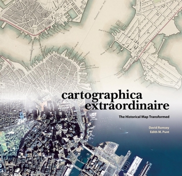
Cartographica Extraordinaire: The Historical Map Transformed

Assembling some of the finest cartographic examples from private collection of renowned map collector David Rumsey, this atlas bridges the gap between historical cartography and exploration and the new technologies and applications of geographic information systems (GIS). More than a lavish collection of cartographic masterworks, this book tells two paralled stories. The first story lays out the relevant history, the human players, and the events that place each map in the context of the time in which it was created. The second thread, of particular interest to cartographers, designers, map lovers, and geographers, tells the stories of the maps themselves--how they were created and the lessons they can teach modern cartographers and other designers of information and visual communication.
Format:Hardcover
Language:English
ISBN:1589480449
ISBN13:9781589480445
Release Date:March 2004
Publisher:Esri Press
Length:200 Pages
Weight:0.05 lbs.
Dimensions:13.4" x 0.8" x 14.1"
Customer Reviews
5 ratings
map lovers, look out!
Published by Thriftbooks.com User , 19 years ago
this is truly an extraordinary book, with excellent reproductions of all types of maps. the index provides the original map dimensions, which i found helpful. this book would be a great additional to any library, young or old.
History Through Illuminating Maps
Published by Thriftbooks.com User , 20 years ago
David Rumsey was fascinated by maps as a kid, and they were always papered onto the walls of his room. The fascination with maps did not leave him, through several degrees in fine art and a career in real estate. He amassed one of the largest private collections of maps, The David Rumsey Historical Map Collection, 150,000 catalogued items stored on the ground floor of his house in San Francisco, which is a working library for people to use. The items are wall maps, folding maps, globes, map puzzles, and many others. There is a sampling of the collection in _Cartographica Extraordinaire: The Historical Map Transformed_ (ESRI Press) by David Rumsey and Edith M. Punt, a slim but large-paged, handsome volume containing all kinds of maps concentrating on North America. They show the history of America, to be sure, but are also a history of mapmaking. Rumsey has painstakingly put items in his collection on the Internet, so he himself is participating in mapmaking history, and some pages of this beautiful book demonstrate what can be done with maps transformed into pixels. Looking at these lovely maps is to participate a bit in Rumsey's enthusiasm, which one can pick up from his introduction: "A map, especially a historical map, ... communicates both above and below the narrow bands of language and observation." There are only a hundred and twenty or so maps selected here, but besides being beautiful objects to contemplate, they show an amazingly diverse range of ideas: how people explored coasts, or how train schedules were arranged before we had standard time zones, or how we claimed, organized, and sold the land. For those of us who only look at highway maps, there is an enormous education here. It is barely possible to mention the subjects of some of these maps; if this subject matter at all interests you, nothing will do except to get the book itself and look through the pages. For instance, the map by William Clark (of Lewis and Clark) of the trek across western America is here, but in a version issued by Rumsey in celebration of the 200th anniversary of their travels. It shows the original drawing, seamlessly enclosed within the General Land Survey's first map of the area, which is itself within a 1971 map of a US Geographic Survey National Atlas, which in turn is within a Landsat mosaic from NASA. The joins of the maps are seamless because they all were turned into computer data that could be massaged in just the right way, and because they are "georectified" to match up perfectly. This was hardest to do with Clark's 1814 map, which because of survey and navigation limitations of his time (not because of sloppy mapmaking) had accurate latitudes and distorted longitudes. Rumsey's collection exists physically, of course, but access to the historical maps entailed the basic problem of "many hands taking hold of rare and delicate objects." Digital photography and computer storage have opened his collection for anyone who wants to loo
An outstanding and representative collection
Published by Thriftbooks.com User , 21 years ago
The impressively collaborative work of David Rumsey (President of Cartography Associates, a San Francisco-based digital publishing company, and Director of Luna Imaging, a provider of enterprise software for online image collections) and Edith M. Punt (professional cartographer and recipient of the 1996 National Geographic Award in Cartography), Cartographica Extraordinaire: The Historical Map Transformed is a 160-page, hardcover, coffee-table book printed on archival paper which showcases how technology has literally transformed the restoration, re-creation and reproduction of historical maps. The specific focus is upon maps (and the people who made them) that reflect American history and ranges from a 1736 atlas depicting California as an island, to a Civil War era "bird's-eye" view of military positions on the southeastern seaboard. This is an outstanding and representative collection drawn from the David Rumsey Map Collection and illustrates early American history from a uniquely geographic perspective. With it's informed and informative text, Cartographica Extraordinaire is clearly recommended for inclusion into professional, academic and community library Cartography Studies or American History collections. Indeed, Cartographica Extraordinaire would make an excellent selection for a truly unique Library Memorial Fund acquisition.
Not just extraordinary, it's amazing
Published by Thriftbooks.com User , 21 years ago
At first sight, this is a gorgeous book. It exhibits historical maps made in nineteenth century America, and the reader might expect a reverential approach of the map collector that David Rumsey exemplifies. But David Rumsey is also the person who provides amazing open access to his collection through the highest tech web site. He sees maps not just as curiosities, but as a way to get inside the past. With Edith Punt, they have tied the maps into the social, environmental and technological changes that are shown. They use the most current geographic information systems technology to spark a connection to the current landscape. The old fragile maps come alive. While this book has the format and polish of your average coffee table book, this is a book to read and reread.
Maps: A Fascinating Study
Published by Thriftbooks.com User , 21 years ago
Maps are fascinating and CARTOGRAPHICA EXTRAORDINAIRE takes us back to the beginnings of mapping what we know now as the United States. It reveals such mysteries as how a survey of a piece of land in California is tied to a point on the north shore of the Ohio River. One can look at how the land was settled and mapped in Illinois or examine an early map of Boston and compare it with the transformation by Frederick Olmstead. This is a book for history buffs.
Copyright © 2025 Thriftbooks.com
Terms of Use | Privacy Policy | Do Not Sell/Share My Personal Information | Cookie Policy | Cookie Preferences | Accessibility Statement
ThriftBooks ® and the ThriftBooks ® logo are registered trademarks of Thrift Books Global, LLC
ThriftBooks ® and the ThriftBooks ® logo are registered trademarks of Thrift Books Global, LLC
