


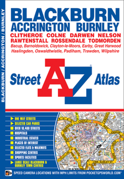
Blackburn & Burnley A-Z Street Atlas
No Customer Reviews

This atlas of Blackburn, Burnley and Accrington contains 50 pages of coloured street mapping. The continuous coverage around Blackburn, Burnley and Accrington extends to include:*Barrowford, Colne, Trawden, Nelson, Whalley, Higham, Brierfield, Harle Syke, Langho, Wilpshire, Great Harwood, Clayton-le-Moors, Padiham, Rose Grove, Worsthorne, Mellor, Rishton, Oswaldtwistle, Pleasington, Baxenden, Goodshaw, Darwen, Rossendale, Rawtenshaw and Bacup.*Also included are large scale town centre maps of Blackburn and Burnley.There is separate coverage of Todmorden, Clitheroe, Barnoldswick and Earby.Postcode districts and one-way streets are featured on the mapping.The index section of the atlas lists streets, selected flats, walkways and places of interest, place, area and station names, hospitals and hospices covered by the atlas.
Format:Paperback
Language:English
ISBN:1843485540
ISBN13:9781843485544
Release Date:August 2012
Publisher:Geographers’ A-Z Map Co Ltd
Length:76 Pages
Weight:0.20 lbs.
Dimensions:8.5" x 0.2" x 5.9"
Customer Reviews
0 rating
Copyright © 2026 Thriftbooks.com
Terms of Use | Privacy Policy | Do Not Sell/Share My Personal Information | Cookie Policy | Cookie Preferences | Accessibility Statement
ThriftBooks ® and the ThriftBooks ® logo are registered trademarks of Thrift Books Global, LLC
ThriftBooks ® and the ThriftBooks ® logo are registered trademarks of Thrift Books Global, LLC
