
Arizona Recreation Map
No Customer Reviews

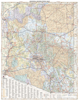
The Arizona Recreation Map is a folded map version of the Recreation Guide pages within our Arizona Road & Recreation Atlas. One side provides a full state map that features Public and Tribal Lands, extensive highway detail, point-to-point mileages, recreation attractions, campgrounds, parks and wildlife areas, fishing access and hunting units (GMU), and a detailed list of Arizona cities and towns with populations and grid references. The reverse side includes categorized recreation listings with helpful descriptions, current contact information, and map grid references.
Map Scale = 1:829,265Sheet Size = 34" x 27"Folded Size = 4" x 9"Format:Map
Language:English
ISBN:0783499094
ISBN13:9780783499093
Release Date:January 2017
Publisher:National Geographic Maps
Length:2 Pages
Weight:0.15 lbs.
Dimensions:0.2" x 4.3" x 9.0"
Customer Reviews
0 rating
Copyright © 2025 Thriftbooks.com
Terms of Use | Privacy Policy | Do Not Sell/Share My Personal Information | Cookie Policy | Cookie Preferences | Accessibility Statement
ThriftBooks ® and the ThriftBooks ® logo are registered trademarks of Thrift Books Global, LLC
ThriftBooks ® and the ThriftBooks ® logo are registered trademarks of Thrift Books Global, LLC
