


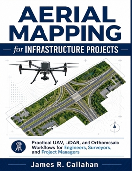
Aerial Mapping for Infrastructure Projects: Practical UAV, LiDAR, and Orthomosaic Workflows for Engineers, Surveyors, and Project Managers
No Customer Reviews

Aerial Mapping for Infrastructure Projects
Practical UAV, LiDAR, and Orthomosaic Workflows for Engineers, Surveyors, and Project Managers
Published independently by James R. Callahan Infrastructure projects are moving faster, becoming more data-driven, and demanding better decision-making than ever before. Yet many teams still struggle with inconsistent aerial mapping workflows, unreliable deliverables, confusing software pipelines, poor QA/QC practices, and costly field mistakes that delay projects and reduce confidence in the data. Aerial Mapping for Infrastructure Projects was written to solve those problems. Whether you are working on roads, bridges, rail corridors, construction sites, utilities, drainage systems, land development, inspections, or earthworks, this practical guide shows you how to plan, capture, process, validate, and deliver professional aerial mapping results using UAVs, LiDAR, photogrammetry, orthomosaics, DEMs, DSMs, DTMs, GIS, CAD, and BIM workflows. This is not a theory-heavy academic textbook.
It is a real-world workflow manual designed to help engineers, surveyors, UAV operators, GIS professionals, construction teams, and project managers produce reliable, repeatable, and actionable mapping deliverables with greater confidence. Inside this book, you will learn how to: Select the right UAV platforms and sensors for different infrastructure projectsPlan mapping missions for accuracy, efficiency, and safetyUse RTK/PPK workflows and ground control effectivelyCapture high-quality aerial imagery and LiDAR dataProcess orthomosaics, point clouds, DEMs, DSMs, and DTMsValidate accuracy using checkpoints, RMSE analysis, and QA/QC proceduresIntegrate deliverables into GIS, CAD, and BIM environmentsManage construction monitoring and progress tracking workflowsPerform infrastructure inspections and condition assessmentsReduce common field and processing mistakes before they become expensive problemsBuild scalable workflows for repeat infrastructure projectsUnderstand future trends including AI, cloud processing, automation, and digital twinsYou will also discover practical guidance for: Road and highway mappingBridge inspection workflowsRail and utility corridor projectsFloodplain and drainage analysisEarthwork volume calculationsStakeholder reportingClient deliverablesProject documentationData management and version controlUnlike generic drone books that focus only on flying, this guide focuses on complete infrastructure mapping workflows from project planning to final delivery. Every chapter includes: Professional workflow explanationsReal operational guidancePractical field observationsQA/QC recommendationsKey takeawaysPractical exercisesRepeatable best practices for real-world project environmentsIf you want to improve mapping accuracy, avoid costly rework, strengthen deliverable quality, and build aerial mapping systems that infrastructure teams can trust, this book provides the practical framework to help you do it professionally and consistently.
Practical UAV, LiDAR, and Orthomosaic Workflows for Engineers, Surveyors, and Project Managers
Published independently by James R. Callahan Infrastructure projects are moving faster, becoming more data-driven, and demanding better decision-making than ever before. Yet many teams still struggle with inconsistent aerial mapping workflows, unreliable deliverables, confusing software pipelines, poor QA/QC practices, and costly field mistakes that delay projects and reduce confidence in the data. Aerial Mapping for Infrastructure Projects was written to solve those problems. Whether you are working on roads, bridges, rail corridors, construction sites, utilities, drainage systems, land development, inspections, or earthworks, this practical guide shows you how to plan, capture, process, validate, and deliver professional aerial mapping results using UAVs, LiDAR, photogrammetry, orthomosaics, DEMs, DSMs, DTMs, GIS, CAD, and BIM workflows. This is not a theory-heavy academic textbook.
It is a real-world workflow manual designed to help engineers, surveyors, UAV operators, GIS professionals, construction teams, and project managers produce reliable, repeatable, and actionable mapping deliverables with greater confidence. Inside this book, you will learn how to: Select the right UAV platforms and sensors for different infrastructure projectsPlan mapping missions for accuracy, efficiency, and safetyUse RTK/PPK workflows and ground control effectivelyCapture high-quality aerial imagery and LiDAR dataProcess orthomosaics, point clouds, DEMs, DSMs, and DTMsValidate accuracy using checkpoints, RMSE analysis, and QA/QC proceduresIntegrate deliverables into GIS, CAD, and BIM environmentsManage construction monitoring and progress tracking workflowsPerform infrastructure inspections and condition assessmentsReduce common field and processing mistakes before they become expensive problemsBuild scalable workflows for repeat infrastructure projectsUnderstand future trends including AI, cloud processing, automation, and digital twinsYou will also discover practical guidance for: Road and highway mappingBridge inspection workflowsRail and utility corridor projectsFloodplain and drainage analysisEarthwork volume calculationsStakeholder reportingClient deliverablesProject documentationData management and version controlUnlike generic drone books that focus only on flying, this guide focuses on complete infrastructure mapping workflows from project planning to final delivery. Every chapter includes: Professional workflow explanationsReal operational guidancePractical field observationsQA/QC recommendationsKey takeawaysPractical exercisesRepeatable best practices for real-world project environmentsIf you want to improve mapping accuracy, avoid costly rework, strengthen deliverable quality, and build aerial mapping systems that infrastructure teams can trust, this book provides the practical framework to help you do it professionally and consistently.
Format:Paperback
Language:English
ISBN:B0H396RR5Y
ISBN13:9798199058728
Release Date:May 2026
Publisher:Independently Published
Length:240 Pages
Weight:1.25 lbs.
Dimensions:0.5" x 8.5" x 11.0"
Customer Reviews
0 rating
Copyright © 2026 Thriftbooks.com
Terms of Use | Privacy Policy | Do Not Sell/Share My Personal Information | Cookie Notice | Cookie Preferences | Accessibility Statement
ThriftBooks ® and the ThriftBooks ® logo are registered trademarks of Thrift Books Global, LLC
ThriftBooks ® and the ThriftBooks ® logo are registered trademarks of Thrift Books Global, LLC
