


< Back to Search Results
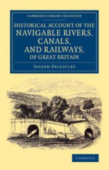
Historical Account of the Navigable Rivers, Canals, and Railways, of Great Britain: As a Reference to Nichols, Priestley and Walker's New Map of Inlan
No Customer Reviews

Select Format
Select Condition 
Book Overview
This account of the waterways and railways of Great Britain covers those transport routes and systems of inland navigation that had been completed or were in construction at the time of publication in 1831. Not to be confused with his polymath namesake, Joseph Priestley (1766-1852) entrenched his expertise as manager of the Aire and Calder Navigation. Here he provides alphabetical entries ranging from the Aberdare Canal in Glamorganshire to the Wyrley and Essington Canal in the Midlands. Details are given regarding location, construction, relevant Acts of Parliament, and even tonnage rates. Published to accompany a huge map of British inland navigation (a smaller version is featured here as the frontispiece), the book became a standard reference work in its day. Shedding light on the development of commercially crucial infrastructure, it remains valuable to readers and researchers interested in the history of British transport and technology.
Format:Paperback
Language:English
ISBN:1108069959
ISBN13:9781108069953
Release Date:August 2014
Publisher:Cambridge University Press
Length:738 Pages
Weight:2.03 lbs.
Dimensions:1.6" x 5.5" x 8.5"
Customer Reviews
0 rating
Copyright © 2026 Thriftbooks.com
Terms of Use | Privacy Policy | Do Not Sell/Share My Personal Information | Cookie Policy | Cookie Preferences | Accessibility Statement
ThriftBooks ® and the ThriftBooks ® logo are registered trademarks of Thrift Books Global, LLC
ThriftBooks ® and the ThriftBooks ® logo are registered trademarks of Thrift Books Global, LLC
