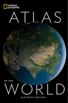
National Geographic Atlas of the World, 11th Edition
Select Format
Select Condition 
Book Overview
Created for all global citizens, this universally respected volume of world maps has been completely revised and updated with fascinating visualizations of international trends and global conditions. National Geographic's flagship Atlas of the World, now in its 11th edition, provides authoritative maps of every country, ocean, and region of the world, as well as thematic maps and accompanying graphics showing important population,...
Format:Hardcover
Language:English
ISBN:1426220588
ISBN13:9781426220586
Release Date:October 2019
Publisher:National Geographic Society
Length:448 Pages
Weight:3.05 lbs.
Dimensions:1.6" x 12.5" x 18.8"
Customer Reviews
4 ratings
Easily the best there is, a true achievement
Published by Thriftbooks.com User , 15 years ago
National Geographic have compiled the most comprehensive blue-print of planet Earth and its surroundings. (the moon, mars, milky way etc) The book is well designed aesthetically and practically, beautiful in it's complexity but organized in a way thats easy to follow. it doesn't get any better than this. Most guests at my house notice the giant blue book pretty quickly and have shown nothing but amazed impressions. I definitely approve of this (honestly) hefty purchase. It's worth it
National Geographic has made changes
Published by Thriftbooks.com User , 18 years ago
In December 2004, National Geographic (NG) updated the Persian Gulf plate (Plate 75) to accomodate the controversies surrounding the place-names used in the 8th edition. Here is my understanding of the changes made:1. The term "Arabian Gulf" in parenthesis has been deleted. Instead, there is a small note that reads: "Historically and commonly known as the Persian Gulf, this body of water is also referred by some as the Arabian Gulf."2. Persian names of all Iranian islands are used. (Kish instead of Qeys, Lavan alone instead of adding Sheykh Sha'eyb in parenthesis)3. Deletion of "Occupied by Iran (Claimed by U.A.E.)" in reference to the islands Abu Musa, and Greater and Lesser Tunbs.These changes already appear on the website (www.nationalgeographic.com/mapmachine) and will apply to further printings or editions of the NG Atlas. Also, on the password-protected website for NG Atlas owners, there is a "brief summary of the historical origin of the term Persian Gulf". There is also a note on the place-naming policy of NG. (The online update feature is great - you can download and/or print updated plates and put them in your atlas. This not new for NG Atlases, except that they used to send updates by mail.)Overall, I am impressed with NG's response to this situation. I am also very impressed with the quality of the atlas and its contents, except for the outermost/superficial binding paper. I have had the atlas for about 6 months, and with moderate use, the paper around the bottom of the spine has frayed. The binding itself is intact, though.
Dollar For Dollar The Best World Atlas
Published by Thriftbooks.com User , 22 years ago
The National Geographic Society (NGS) Atlas of the World is an "evolutionary" rather than a "revolutionary" publication. Besides updated boundaries, etc., compared to prior editions it makes much better use of shading to indicate topography and has more detailed city maps. I buy an atlas primarily for the maps, and it's the maps that make the NGS Atlas superior to all others. The traditional NGS "look" sometimes seems dated compared to the flashier colors and trendy graphics employed by some other publishers. However, the more I study the maps, the more information I find in them. A few years ago I did a comparison of this NGS with the most recent edition of the much more expensive Times Atlas of the World for a professional geographer's meeting. I was amazed to find that many of the NGS maps of North America had more than twice as many place names and named physical features as the Times Atlas. I also found the NGS Atlas maps equal or superior to the Times' maps for parts of the Middle East and northeast Asia with which I'm familiar (frankly, I found the 10th Edition Times Atlas inferior to the prior edition in several regards; for example, the elevation colors are far less discernable and detailed city maps have been virtually eliminated). Despite contrary opinions by some other reviewers, I judge the National Geographic Atlas maps to be far and away superior in content and sheer volume of information presented to all the other "high end" atlases published by Oxford, Hammond and DK. In fact, I couldn't justify recommending any of the other atlases (except possibly the Times, which, I admit, does offer fantastic detail for village names in the rural plains of India where I hope to never visit) to a library. The National Geographic Society Atlas of the World is a great investment for travel planning, tracking current events, studying geography and history or just reading maps for pleasure. I recommend it highly.
Probably the easiest and most fun to look at and use.
Published by Thriftbooks.com User , 24 years ago
I also own what may be considered the definitive world atlas - that of The Times. The Times atlas has shaded colors for elevations and greater general detail than that of the National Geographic Atlas.Still, for me, I find myself picking up the National Geographic Atlas way more often. Why? Simply put, it's just the most enjoyable to look at and easiest and most fun to use. I like it better.A great work.


